 |
|---|
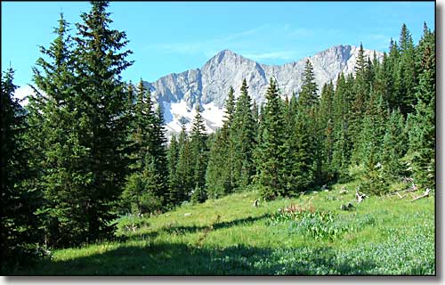
The Colorado Mountains |
|
|
 Approaching the north wall of Mt. Blanca |
|
Slowly I'm getting around to the peaks in our area. I doubt that I'll ever climb them all but I can get close enough to get some good shots. And several of the peaks in our area that I am interested in climbing are on private property and permission to climb is hard to come by. That still leaves a lot of 13 and 14,000 foot mountains for me to play on. I also much prefer to have my mountain time during the week. Weekends on a high mountain: I've heard stories of 4-hour waits to get through the Keyhole on Long's Peak because of the sheer number of climbers. That's also a good reason for enjoying the 13ers: there's no people on them. For anyone climbing any Colorado mountain higher than 13,800 ft. I highly recommend Gerry Roach's Colorado's Fourteeners and Colorado's Thirteeners (written with his wife Jennifer). These two books with their excellent maps, photos and multiple route descriptions are indispensable. At times in my descriptions of mountains or areas I quote from these texts. The list of Colorado's highest mountains is taken from the Thirteener book. I am indebted to Gerry and Jennifer for their willingness and ability to share their love for the mountains and other high places. If you are interested in learning more from the horse's mouth (so to speak), try Gerry Roach. If you purchase one of his books directly from him you'll get a signed copy for your efforts. |
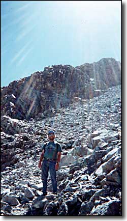
Remember when you go climbing here, thunderstorms blow in in minutes at altitude. And when you are working your way through a sea of rock, you make an excellent lightning rod. Every year a few people get hit. Most live, but some... So I do everything I need to, to be headed back down the hill before noon, some days even earlier. Another thing to be aware of is altitude sickness. For myself, if I'm going above 13,500 feet, I much prefer to sleep at 10,000 feet or better the night before. Doing that, I have never had a problem up there (and I live at 7,600 feet). Rain gear, sunblock, hat, bandaids, gorp, lunch, lots of water, sunglasses, a compass, USGS map, survey tape, trekking poles (I have really bad knees), a good camera, binoculars, and a cell phone (but don't count on it) round out what's usually in my backpack. I like to maximize the joy, the wonder and the safety of the experience. If I can drive to the bottom of the hill I take less, if I'm deep in the mountains I take more. And I always check the long range weather forecast before I leave the house. I'm in it for the fun and the adventure. I have come across people out there who didn't do any of this, and they were hurting. That's me on the left, coming down Mt. Lindsey. |
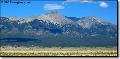 Little Bear Peak in the center  Mt. Sneffels |
 |
|
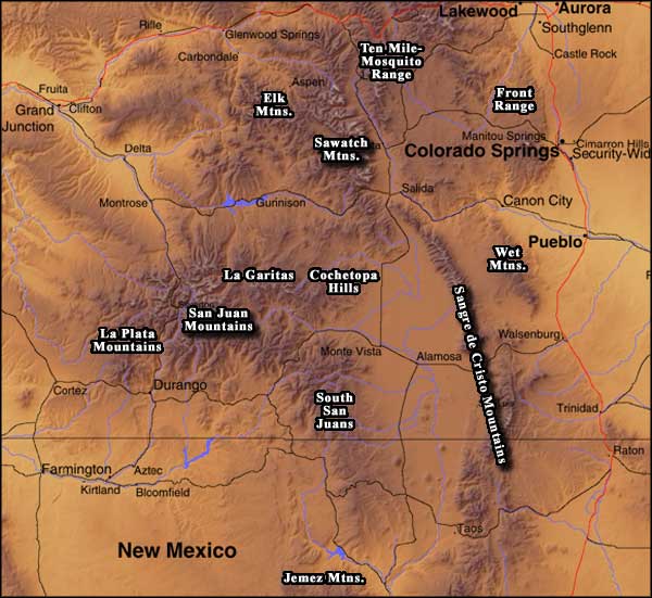
Just select a mountain group name and you will be taken to that part of sangres.com. Not every name has its' own page yet. |
|
And you can use the list below for individual peaks: |
| Clicking on any of these photos will open a new window or new tab in your browser and bring you a larger version of that photo. 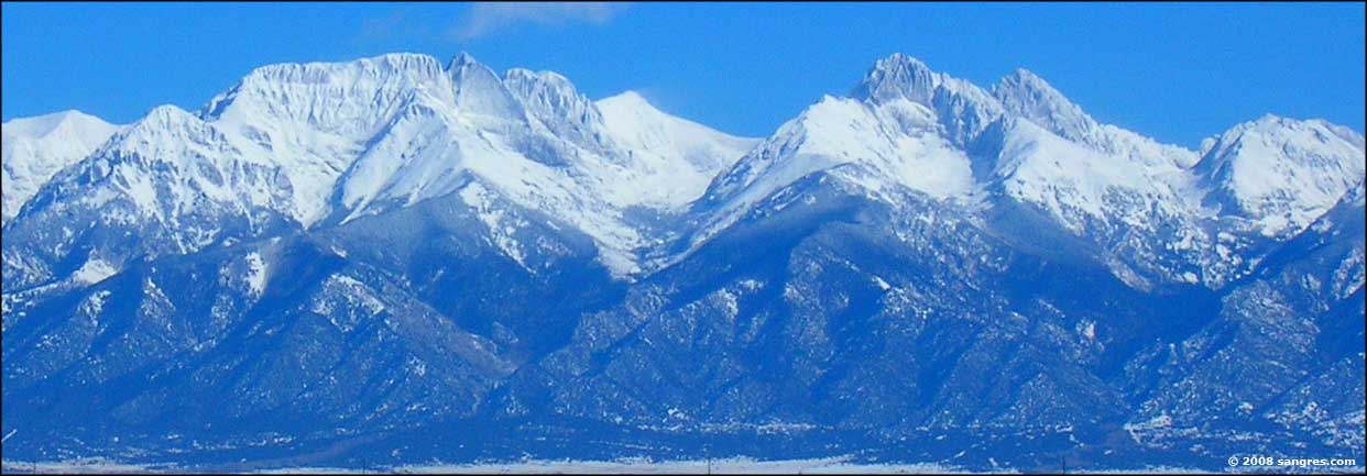 Challenger Point, Kit Carson Peak, Columbia Point, Crestone Peak, Crestone Needle, left to right  The Crestones in the center, Humboldt to the right |
|
|
Related Pages
Sangre de Cristo Mountains - Sawatch Mountains - San Juan Mountains
Colorado Mountain Club - Summitpost.org The Highest Mountains in ColoradoPanoramic PhotosColorado Pages
Towns & Places - Scenic Byways - State Parks - BLM Sites - History & Heritage Ski & Snowboard Areas - Photo Galleries - Colorado Mountains - Scenic Railroads Unique Natural Features - Wilderness Areas - Outdoor Sports & Recreation Colorado's National Forests - National Wildlife Refuges - Colorado's National Parks |

|
| Index - Arizona - Colorado - Idaho - Montana - Nevada - New Mexico - Utah - Wyoming National Forests - National Parks - Scenic Byways - Ski & Snowboard Areas - BLM Sites Wilderness Areas - National Wildlife Refuges - National Trails - Rural Life Advertise With Us - About This Site - Privacy Policy |
| Photos courtesy of Sangres.com, CCA ShareAlike 3.0 License. Map courtesy of Cartesia MapArt Terrain. Text Copyright © by Sangres.com. All rights reserved. |