|
|||||||||||||||
|---|---|---|---|---|---|---|---|---|---|---|---|---|---|---|---|
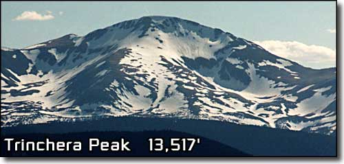
Trinchera PeakSangre de Cristo Mountains |
|||||||||||||||
|
|
|||||||||||||||
|
|||||||||||||||
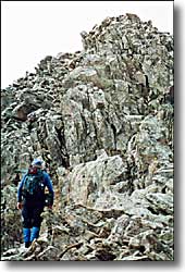
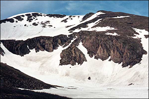
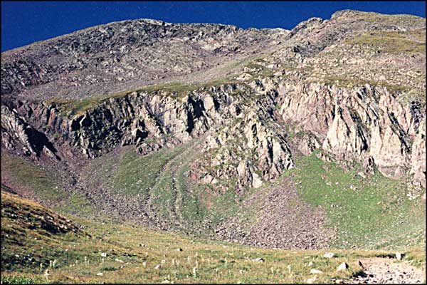
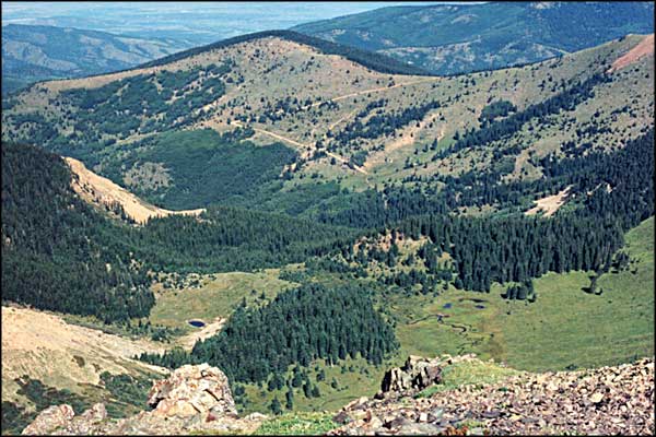
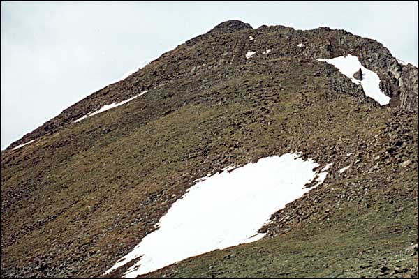
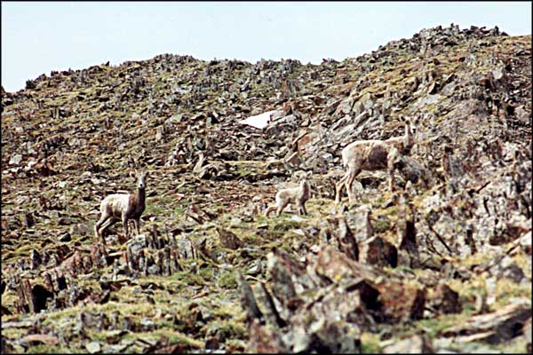
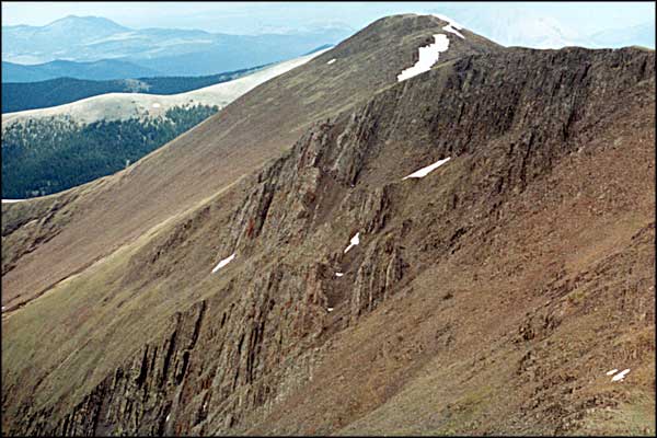
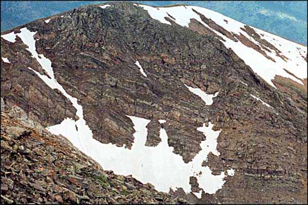
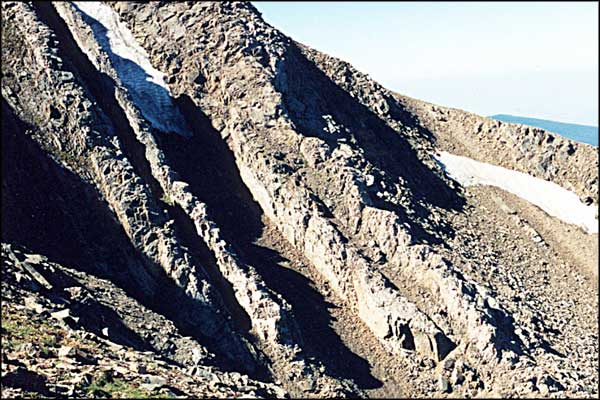
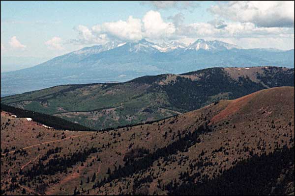
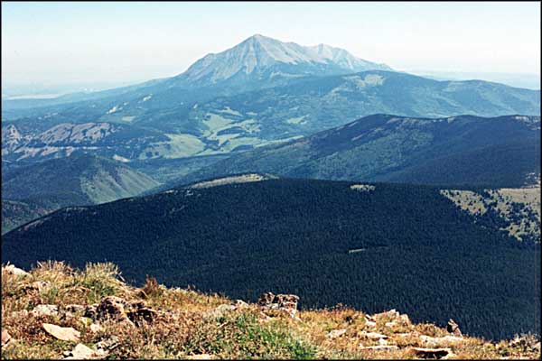
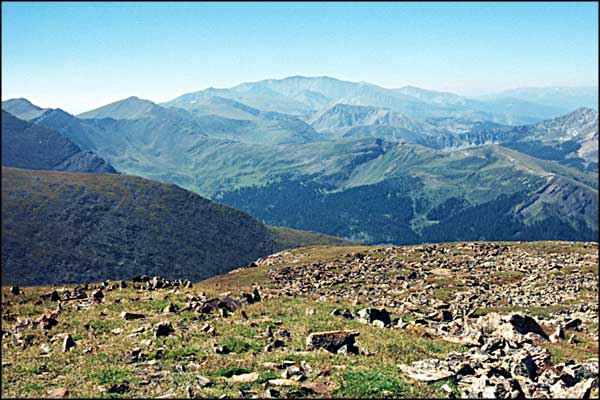
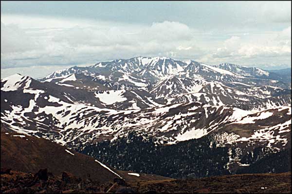
This small collection of photos commemorates several of our climbs on Trinchera Peak in the Sangre de Cristo Mountains of southern Colorado. Bill and I chose a beautiful Saturday morning in mid-September for our first climb and the weather was magnificent. We left town at 7:00 am headed west on Highway 12, the Scenic Highway of Legends. After crossing Cuchara Pass (9,995') we went down the hill to where the Cuchara River emerges from the hills west of us and drove four miles in, just past the Blue Lake Campground. 1/4 mile up the road on the left we parked in the parking area and began the walk up. There is a reasonably drivable jeep trail there that goes up for three miles to the crest of the mountain ridge (approx. 12,500' elevation) between Trinchera Peak and Teddy's Peak. At that crest there is an incredible view down into the valley on the west side of the Sangre de Cristo's and across the San Luis Valley. However, it was harvest time in the valley and the dust layer in the atmosphere below us to the west obscured a lot of the view. There is no real trail from that saddle to the top of the mountain but there are footprints in places and the rock faces that fall away on both sides of the mountain force everyone to climb through the same small notch in the cliffs and rocks in order to reach the top. Once you are over the notch, the backside of the mountain opens in a huge, rockstrewn meadow that goes all the way to the top. The top itself is a pretty wide open ridge with a large rock cairn at its highest point. The view was spectacular (what else could it be?) We shot film, ate lunch, toasted life, and started down. But we chose to go down on the south side of the peak to avoid the rock faces and cliffs (we hoped.) We soon found ourselves on all fours going down a 45 to 60 degree slope. And it went for a thousand feet down like that. We stopped regularly and enjoyed the views. That's when we started to see the bighorn sheep all around us. But we couldn't get close to them. Just as well. We only met half a dozen people on the mountain, all of them in one group. Trinchera Peak was, in some respects, a harder climb than the West Spanish Peak and it seems to be somewhat less popular. The presence of the bighorns more than made up for the lack of other climbers. This is a good climb from late spring to early fall. I tend do it at least once a year (just for the exercise). |
|||||||||||||||
| Clicking on any of these photos will open a new window or new tab in your browser and bring you a larger version of that photo. |
|||||||||||||||
| |||||||||||||||
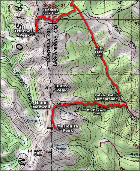 Trinchera Peak area map |
|||||||||||||||
|
|
|||||||||||||||
Trinchera Peak Related Pages
Cuatro Peak - Spanish Peaks - Mariquita Peak - Mount Maxwell
Potato Patch Campground - Las Animas County - Huerfano County San Isabel National Forest PagesColorado Pages
Towns & Places - Scenic Byways - State Parks - BLM Sites - History & Heritage Ski & Snowboard Areas - Photo Galleries - Colorado Mountains - Scenic Railroads Unique Natural Features - Wilderness Areas - Outdoor Sports & Recreation Colorado's National Forests - National Wildlife Refuges - Colorado's National Parks |
|||||||||||||||

|
|||||||||||||||
| Index - Arizona - Colorado - Idaho - Montana - Nevada - New Mexico - Utah - Wyoming National Forests - National Parks - Scenic Byways - Ski & Snowboard Areas - BLM Sites Wilderness Areas - National Wildlife Refuges - National Trails - Rural Life Advertise With Us - About This Site - Privacy Policy |
|||||||||||||||
| Photos courtesy of Sangres.com, CCA ShareAlike 3.0 License. Map courtesy of National Geographic Topo! Text Copyright © by Sangres.com. All rights reserved. |