 |
|---|
Sheep and Little Sheep MountainsHuerfano County, Colorado |
|
|
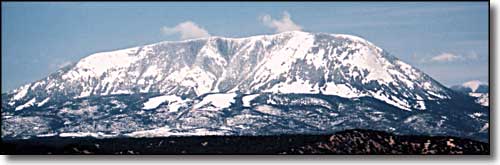
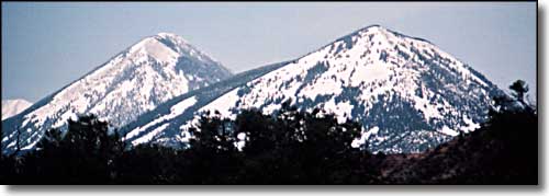 Sheep Mountain (left) and Little Sheep Mountain (right), from the north 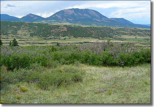 Sheep Mountain from the southeast |
|
Sheep (10,635') and Little Sheep (9,679') Mountains are in a line heading northward from Mt. Mestas. Both of these mountains are composed of the same granitic stock materials as Mt. Mestas, Silver Mountain, Rough Mountain, and the Spanish Peaks. Climbing on them is climbing mostly on boulders and loose talus slopes. Even under the trees nearly everything is loose. ARCO was drilling in this area a number of years ago, looking for natural gas. What they found was a large bubble of carbon dioxide. These days there is a pipeline running from this area down to the Permian Basin in west Texas carrying that CO2 to be pumped down injection wells to force more oil out. |
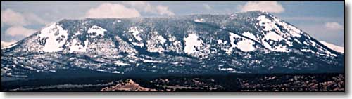
 Sheep Mountain from the northeast |
|
The "mass" of both of these mountains is owned by the BLM, however, there is at least one subdivision of 35-40 acre properties at the foot of them bordering on the BLM. Forget utilities ("the grid") in most of the area. In my travels around these mountains the only road that seems to get regular maintenance is Pass Creek Road on the west side. I've been over several of the county roads on the east side and most of them are unmarked, never mind regularly maintained. |
 Little Sheep Mountain from the northeast 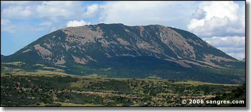 Sheep Mountain from the southeast 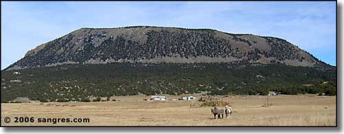 Little Sheep Mountain, from the west 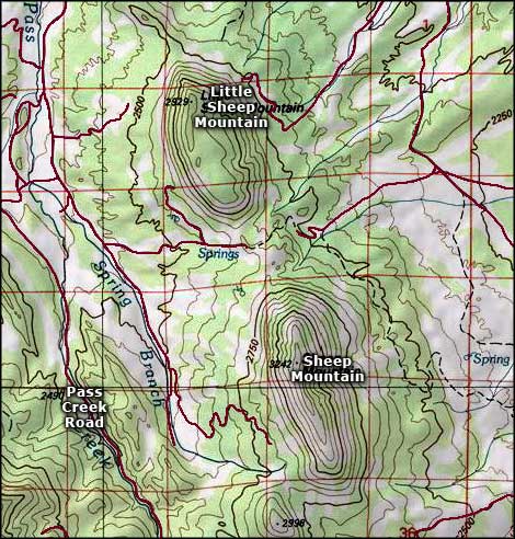 Sheep Mountains area map |
|
|
Sheep Mountains Related PagesColorado Pages
Towns & Places - Scenic Byways - State Parks - BLM Sites - History & Heritage Ski & Snowboard Areas - Photo Galleries - Colorado Mountains - Scenic Railroads Unique Natural Features - Wilderness Areas - Outdoor Sports & Recreation Colorado's National Forests - National Wildlife Refuges - Colorado's National Parks |

|
| Index - Arizona - Colorado - Idaho - Montana - Nevada - New Mexico - Utah - Wyoming National Forests - National Parks - Scenic Byways - Ski & Snowboard Areas - BLM Sites Wilderness Areas - National Wildlife Refuges - National Trails - Rural Life Advertise With Us - About This Site - Privacy Policy |
| Photos courtesy of Sangres.com, CCA ShareAlike 3.0 License. Map courtesy of National Geographic Topo! Text Copyright © by Sangres.com. All rights reserved. |