|
||||||||||
|---|---|---|---|---|---|---|---|---|---|---|
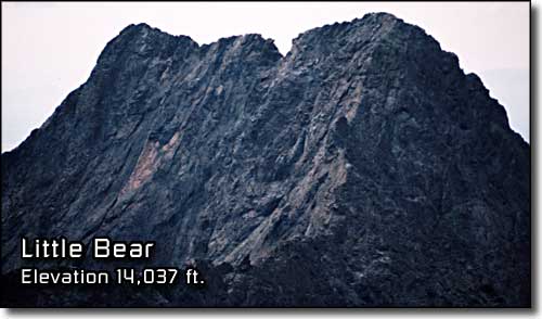
Little Bear PeakBlanca Massif, Sangre de Cristo Mountains |
||||||||||
|
|
||||||||||
|
||||||||||
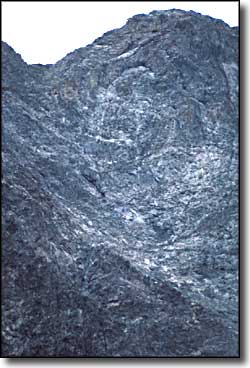
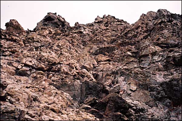
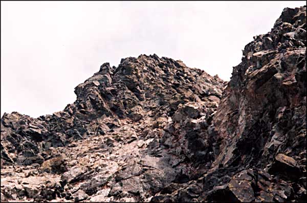
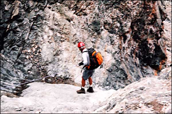
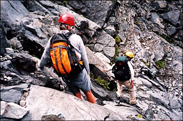
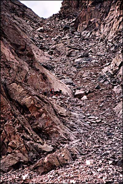
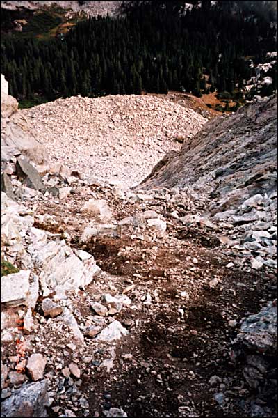
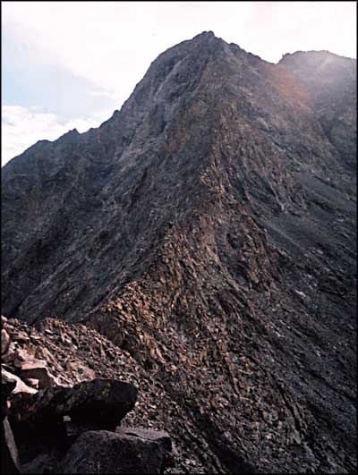
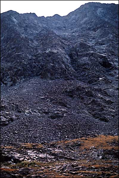
Amateur that I am, I decided early on not to go up on Little Bear. Furi and Bill came equipped for it and on Saturday morning, Greg and George, 2 friends from Denver, came into our camp about 8:00 am. They came with a rope (just in case) and Furi stuck it in his backpack before they started. The day before, Furi, Bill and I scoped out the Northwest Face route (shown on the left). Furi thought that might be better than the Hourglass route but Greg and George had other ideas. I went with them to the foot of the first chute and watched them going up. The rest of this story is a paraphrase of what they had to say when they came back down. And I am indebted to Bill for the photos. The first chute is nasty: loose stuff, boulders, steep rock. It was so loose that climbing the rock was preferable for quite a ways. On clearing the notch, the ridge leading up came into view. They went around the backside (south side) of the ridge and picked their way up through the rock to the foot of the Hourglass. The Hourglass is a gully of water-polished granite, 20 to 30 feet wide and maybe 400 feet long, steep. Fingerholds are very thin. They went up it all right and continued on to the summit. The only way to determine which pile of rocks is the summit is to find the cairn with the registry in it. They ate, shot photos, rested and then started down. When they came back to the top of the Hourglass, most of them hesitated. There were several good anchors in the rock and someone left 150 feet of rope hanging there. Furi (in his cross-trainers) walked down the rock, pulled out his rope and attached it in a matter of seconds to the end of the other rope, then walked back up the rock to the others. George started down and hardly touched the rope. Greg and Bill used the rope heavily. Bill had a problem and Furi came down and helped him out of it. Once Bill was down, Furi detached the rope, coiled it, put it back in his pack, and then walked down the rest of the way. In the middle of descending the ridge, a heavy thundershower started. By the time they reached the chute leading down off the mountain, the rain had become a drizzle and everything was sticky. They sorted of skated down the loose stuff and were back in camp a little after 2:00 pm. We celebrated their success, packed our camp and headed down off the mountain. The rest of the story is contained on the 4WD and Wilderness page. |
||||||||||
| Clicking on any of these photos will open a new window or new tab in your browser and bring you a larger version of that photo. |
||||||||||
| ||||||||||
 Little Bear Peak area map |
||||||||||
|
|
||||||||||
Little Bear Peak Related Pages
Blanca Peak - Ellingwood Point - Traverses - Mount Lindsey - Sierra Blanca
Lake Como - Mountain Stream - Rio Grande National Forest - Como Lake Road California Peak - Zapata Falls National Recreation Area Colorado Pages
Towns & Places - Scenic Byways - State Parks - BLM Sites - History & Heritage Ski & Snowboard Areas - Photo Galleries - Colorado Mountains - Scenic Railroads Unique Natural Features - Wilderness Areas - Outdoor Sports & Recreation Colorado's National Forests - National Wildlife Refuges - Colorado's National Parks |
||||||||||

|
||||||||||
| Index - Arizona - Colorado - Idaho - Montana - Nevada - New Mexico - Utah - Wyoming National Forests - National Parks - Scenic Byways - Ski & Snowboard Areas - BLM Sites Wilderness Areas - National Wildlife Refuges - National Trails - Rural Life Advertise With Us - About This Site - Privacy Policy |
||||||||||
| Photos courtesy of Sangres.com, CCA ShareAlike 3.0 License. Map courtesy of National Geographic Topo! Text Copyright © by Sangres.com. All rights reserved. |