
Spanish Peaks Wilderness
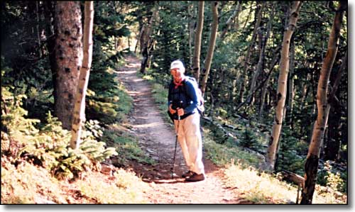
Heading for the West Spanish Peak
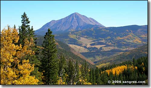
Las Cumbres Espanolas, the Spanish Peaks, are among the most important landmarks of the Southwest. Long before Zebulon Pike attempted to reach the top of Pikes Peak (later named for him), the Spanish Peaks were guiding Indian traders and raiders, Spanish explorers and French trappers and entrepreneurs to the settlements of New Mexico.
Their isolated location and their abrupt rise 7,000 feet above the Great Plains made the twin mountains of special significance to the Ute, Apache, Comanche and earlier tribes who lived nearby. The great mountains were objects of religious awe to the primitive tribes. Summer thunderstorms which cluster about the summits were thought to be evidence that the Rain God lived on the Spanish Peaks.
Inevitably the peaks were thought to be the home of other gods and the deposit for their treasure. The significance of the double mountain to the Indians is found in their names for the Spanish Peaks, Wahatoya, Huajatolla and Guajatoyah, or "Breasts of the World," also "Breasts of the Earth". It was perhaps the Spanish Peaks that were recorded by this name as a source of gold in Aztec annals in far away Mexico City.
The first recorded entry by white men into what is now Colorado was in 1694 when Governor Don Diego de Vargas of Spanish New Mexico led an expedition into the southern San Luis Valley. It is probable that the hardy conquistadors of that day knew of the Wahatoyas already but the first man recorded to pass by the Peaks was Juan de Ulibarri. Ulibarri went north from Santa Fe in 1706, one hundred years before Pike, and was only the first in a long line of Spanish explorers through the area.
One of the most famous Spanish explorers was Governor Juan Bautista de Anza, founder of San Francisco, conqueror of the Comanches and one of the greatest frontiersmen in North American history. In 1779, De Anza surprised the Comanches by circling through San Luis Valley over Poncha Pass through South Park and descending on the Comanche villages from the north. De Anza ended the many years of Comanche terrorism with two decisive battles near today's Colorado City. The Comanche chief, Cuerno Verde, was killed in one of these battles and his warriors finally admitted defeat. After this, the Comanche no longer raided the New Mexico settlements.
After the Louisiana Purchase in 1803, Lt. Zebulon Pike was sent to explore the limits of the new territory. Between his reports and the Mexicans' revolt against Spain, the markets of Santa Fe and Taos were finally opened to American trappers and traders. The Santa Fe Trail was established in 1821, and the Spanish Peaks were important guideposts to early travelers. One branch of the trail, the Taos Trail, passed north of the Peaks along the Huerfano River, up South Oak Creek and over Sangre de Cristo Pass to the San Luis Valley.
Still later the Peaks marked the way for men like Col. John C. Fremont and Capt. John Gunnison who searched for railroad routes to span the continent. Today, the four lanes of Interstate 25 skirt the eastern slopes of East Spanish Peak. The Wahatoyas are still the prominent landmarks they were in the days of New Spain.
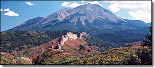
The Devil's Stairstep below the West Spanish Peak
A NOTE ON NAMES: The prominence of the Spanish Peaks has resulted in a different name or spelling by every people who lived near them. The Indian name is spelled at least three different ways in the area: Wahatoya, Huajatolla and Guajatoyah.
NATURAL HISTORY: There is a good variety of wildlife in the area including bear, deer, elk, turkey and grouse. Trout are found in the Purgatoire and Cucharas Rivers and in the following lakes: Bear, Blue, North, Monument, Martin, Horseshoe, Wahatoya and La Veta. Unusual combinations of conifers are a feature of the Spanish Peaks. Bristlecone, limber and ponderosa pines, alpine and white firs, Douglas-fir and Engelmann spruce can be found within yards of each other. An outstanding show of fall colors is exhibited by the aspen and oak brush. The wildflower displays are especially colorful.
RECREATION FACILITIES: San Isabel National Forest maintains campgrounds at Blue Lake, Bear Lake and along Cucharas Creek. In addition, there are several resorts, cabins, private and State campgrounds in the area. Trails, points of interest and the Cordova Pass Scenic Drive offer many recreational opportunities. Please note that private lands both inside and outside the National Forest may be posted against public use.
HOW TO SEE THE PEAKS: The scenic Spanish Peaks and their dikes are best seen by making a loop trip from I-25 near Walsenburg west on Highway 160 to State Highway 12. Take State Highway 12 thru La Veta to Cuchara Pass; then left on the Cordova Pass Road thru the town of Aguilar to I-25 (about 80 miles round trip). Another route from Trinidad is State Highway 12 to Cuchara Pass and turn right on the Cordova Pass Road (about 100 miles round trip). When viewed from Highway 160 between Walsenburg and La Veta, the peaks appear equal in height. The West Peak is actually almost 1,000 feet higher.
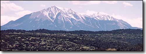
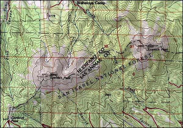
Spanish Peaks Wilderness map
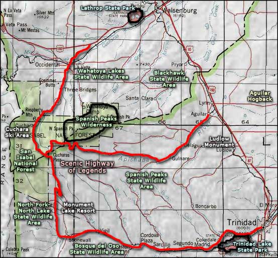
Spanish Peaks Wilderness area map
Selected Hiking Trails
Bosque del Oso State Wildlife Area - Spanish Peaks State Wildlife Area
North Lake-North Fork State Wildlife Area - Wahatoya Lakes State Wildlife Area
Blackhawk State Wildlife Area - Monument Lake Resort
Aguilar Hogback - Ludlow Monument
National Park Service Sites - BLM Sites - National Wilderness Areas - Unique Natural Features
Outdoor Sports & Recreation - Ski & Snowboard Areas - Photo Galleries - Colorado Mountains
