
Naturita, Colorado
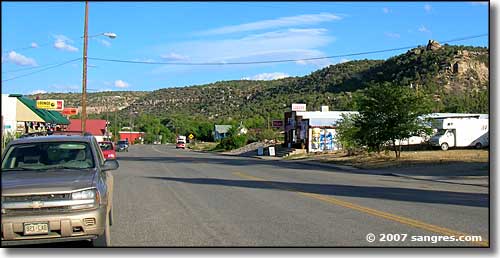
The main road through Naturita
In 1881, Naturita was a close-knit ranching community on the San Miguel River. The town had a post office, a one-room schoolhouse and regular church gatherings and socials. The ranchers pushed their cattle “on the hoof” to railheads in Placerville and Montrose for shipment to market. Then in the 1900’s, copper and carnotite were discovered near Uravan and in the Paradox Valley. That triggered several mineral booms in the area. Naturita being at a natural crossroads for the area, it became a supply center for freighters carrying ore and supplies between Placerville and the mines. While most of the real money went to the corporations that owned the mines (and the prospectors who first discovered them), many local residents made good profits from the service and supply businesses. In between mineral booms, the local folks kept on with their cattle ranches - until the 1950’s.
In 1939, a new mill had opened at Vancoram to process vanadium, a steel-hardening alloy. Secretly, the mill also processed uranium for the US Government’s nuclear weapons research. World War II needs kept the mill busy but demand for uranium skyrocketed after the war ended. Stories proliferated that anyone could stumble on a fortune in uranium nearly anywhere on the Colorado Plateau and Naturita was quickly flooded with miners and millers. Uranium mining dominated the town until the Vancorum mill closed in 1958 due to falling uranium prices. Depending on global mineral prices, the mill at Uravan opened and closed again and again until finally, in 1983, it completely closed down and local residents were forced to diversify again to survive. These days, most residents make their living off cattle ranching, small businesses and tourism. There’s also a lot of oil/gas drilling going on in the area these days.
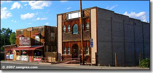
Among the oldest buildings in Naturita
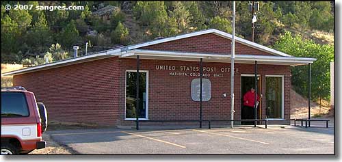
The Post Office in Naturita
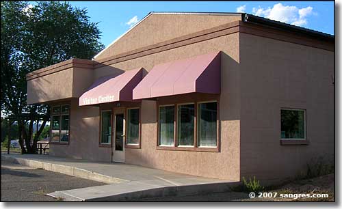
The Unaweep-Tabeguache Scenic & Historic Byway Welcome Center in Naturita
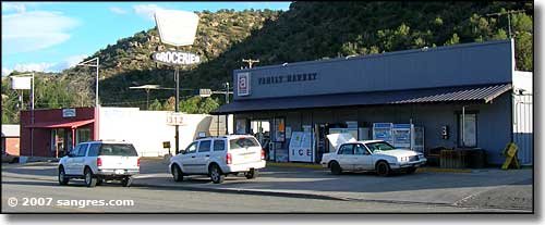
Naturita's supermarket
Latitude: 38.2198°N
Longitude: 108.5675°W
Incorporated: November 30, 1951
Elevation: 5,423'
Education:
High School or Higher: 78.6%
Bachelor's Degree or Higher: 3.4%
Graduate or Professional Degree: 0.5%
2011 Cost of Living Index for Naturita: 90.3
Estimated Median Household Income: $22,400
Estimated Median Home Value: $107,270
Median Resident Age: 35.8 Years
Major Industries:
Construction, Lodging & Food Services, Natural Resources, Educational Services, Government, Health Care, Retail Services
Unemployed (March 2011): 12.8%
Population Demographics: 2010
| Total Population | 546 |
| Males | 267 |
| Females | 279 |
| Population by Age | |
| Under 18 | 134 |
| 18 & over | 412 |
| 20-24 | 17 |
| 25-34 | 54 |
| 35-49 | 112 |
| 50-64 | 119 |
| 65 & over | 102 |
| Population by Ethnicity | |
| Hispanic or Latino | 32 |
| Non Hispanic or Latino | 514 |
| Population by Race | |
| White | 527 |
| African-American | 0 |
| Asian | 0 |
| Native American | 3 |
| Hawaiian or Pacific Islander | 0 |
| Other | 5 |
| Two or more | 11 |
Unaweep-Tabeguache Scenic Byway - Black Canyon of the Gunnison National Park
Uncompahgre National Forest - State Trustlands & Wildlife Areas
National Park Service Sites - BLM Sites - National Wilderness Areas - Unique Natural Features
Outdoor Sports & Recreation - Ski & Snowboard Areas - Photo Galleries - Colorado Mountains
