
Black Canyon of the Gunnison National Park
An Overview of theBlack Canyon of the Gunnison
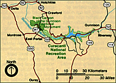
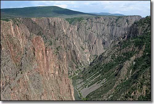
Black Canyon of the Gunnison National Park has been carved by the Gunnison River in its headlong rush to join with the Colorado. The canyon is 53 miles long but only the deepest, most spectacular 14 miles of the gorge lie within the National Park. Although home to an abundant variety of wildlife, the canyon has been a mighty barrier to humans. The walls of the canyon are so steep and the canyon below so narrow (only 40' wide in places across the river) that sunlight usually doesn't make it all the way down.
The Precambrian schist and gneiss that composes the majority of the rock walls here was formed about 1.7 billion years ago. 65 million years ago, the Laramide orogeny pushed up most of Colorado and Utah, including this huge chunk of granite. During the Tertiary period (up to about 25 million years ago), there was some extreme volcanism in the area that buried the uplifted rock up to several thousand feet deep in volcanic ash and debris. About 15 million years ago is when the history of the Gunnison River itself began as runoff from the West Elk and La Sal Mountains and the Sawatch Range began flowing this way and carving into the relatively soft volcanic materials. Then 2 to 3 million years ago, the area was uplifted again, increasing the erosive action of the river on the volcanic debris. Eventually, that flowing water reached the level of the Precambrian rock and began cutting into that. As today's river drops an average of 43 feet per mile as it passes through the canyon (actually dropping 240 feet per mile at Chasm View), and taking into account the fact that the river flowed much stronger in those days, that translates to a cutting action of about 1-inch per 100 years. Cutting that quickly into rock that hard is what made the steep walls of the canyon that we see today. What's different is that a number of feeder canyons that formerly flowed into the Gunnison are now flowing more to the north (and away from the canyon) because of the tilting of the land that has occurred over that last couple million years.
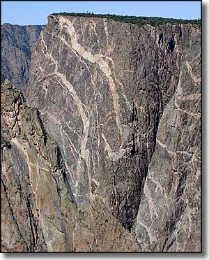
The Painted Wall
Archeological evidence indicates that prehistoric man and the Utes never went into the gorge. It looks like the first white men to see the canyon were with the Hayden Expedition of 1873-74. Although the Hayden Expedition and survey parties for the Denver & Rio Grande Railroad all pronounced the Black Canyon "inaccessible," by the end of the 1800's there was a lot of interest in tapping the Gunnison River as a source of water for the Uncompahgre Valley. In 1901, 2 men using a rubber mattress for a raft and getting supplies lowered from the rim were able to navigate 33 miles of the canyon in 9 days. They kept an engineering log that indicated that an irrigation tunnel was a feasible project and the Gunnison Diversion Tunnel was begun in earnest in January, 1905. Progress was slow because of intense heat, violent cascades of water and unstable rock formations but when finished in September, 1909, the 5.8 mile tunnel carried enough water to irrigate a sizable farming community.
President Herbert Hoover proclaimed Black Canyon of the Gunnison National Monument in March 1933. President Bill Clinton signed an Act of Congress designating it as a National Park in October, 1999. All the land below the rim of the canyon has been designated as a National Wilderness Area to ensure the preservation of its natural conditions forever.

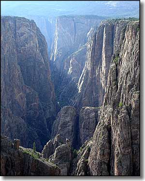
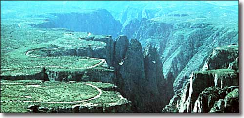
The view from Kneeling Camel Overlook
Black Canyon of the Gunnison National Park has 2 campgrounds: one on each rim. Water must be used sparingly because it is hauled in by tank truck. Each campsite has its own fireplace or charcoal grill and a table. Wood gathering is not permitted. A use fee is charged.
The best way to see the canyon is on foot. A variety of trails lead to overlooks on the rim. While most trails are rated "easy" remember that you are hiking at an 8,000 foot elevation. There are no marked trails into the canyon. If you wish to climb on the sheer walls of the canyon, bring your own equipment and a lot of experience. A backcountry permit is also required. You might also like to consult with the rangers as to the condition of various of the rock walls because if you run into a problem, it can quickly get serious. Of the 145 climbing routes known to the Park Service, 117 have ratings of 5.10 to 5.13. The lowest rated climbs of all the climbs at Black Canyon of the Gunnison National Park are rated as 5.8, but anyone who has ever climbed here knows that all the climbs are committing and the ratings are very deceiving.
As for rafting the river: due to the technical nature of the trip and the number of difficult and dangerous portages, the Gunnison River through Black Canyon of the Gunnison National Park has been officially declared "NOT RAFTABLE." Once the river exits the National Park and enters the Gunnison Gorge National Recreation Area it becomes a different story, with several outfitters offering guided trips through the Gunnison Gorge section of the river.

Gunnison Gorge
