LaVerkin Creek Wilderness

LaVerkin Creek Wilderness is a 453-acre property contiguous to Zion Wilderness near the northern end of Zion National Park. It's an isolated area that is surrounded on three sides by private property. If it wasn't for that boundary contiguous to Zion Wilderness, the property would be too small to qualify for wilderness designation, but LaVerkin Creek Wilderness is also the largest of four BLM wilderness areas contiguous to Zion National Park. The southern boundary of LaVerkin Creek Wilderness Runs for about 1.25 miles along the boundary of Zion National Park.
Nearly the entire property is composed of very steep canyon walls dropping to LaVerkin Creek. LaVerkin Creek is a designated Wild & Scenic River in this area. This is the upper headwaters region of LaVerkin Creek, a tributary of the Virgin River (another designated Wild and Scenic River). LaVerkin Creek flows southward across the Kolob Canyons region of Zion National Park.
The property sits at about 6,800 feet in elevation. The upper flat areas are vegetated with dense stands of pine, juniper and scrub oak. The canyon bottom is a bit on the riparian side as water does often flow in this area.
LaVerkin Creek Wilderness was designated as part of the Omnibus Public Land Management Act of 2009. Most folks access the property by following the LaVerkin Creek Trail north through Zion National Park but the trail officially ends at the boundary with the wilderness area. The fishing can be good at times but it is recommended that you purify any water you use from the creek. Probably the best access to the LaVerkin Creek Trail is off the Kolob Reservoir Road.

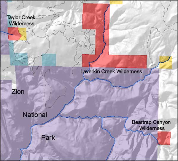
LaVerkin Creek Wilderness location map

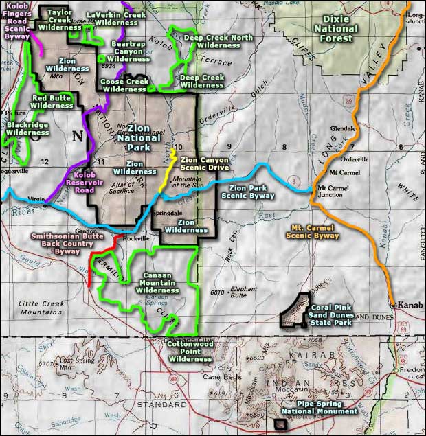
LaVerkin Creek Wilderness area map
Goose Creek Wilderness - Deep Creek Wilderness - Deep Creek North Wilderness
Blackridge Wilderness - Red Butte Wilderness - Canaan Mountain Wilderness
Smithsonian Butte Back Country Byway - Mt. Carmel Scenic Byway
Dixie National Forest - Coral Pink Sand Dunes State Park - Zion National Park
Cottonwood Point Wilderness - Pipe Spring National Monument - Zion Canyon Scenic Drive
Utah's National Parks - Utah's National Forests - Ski & Snowboard Areas
Wilderness Areas - BLM Sites - National Wildlife Refuges
