 |
|||||||||||||||
|---|---|---|---|---|---|---|---|---|---|---|---|---|---|---|---|
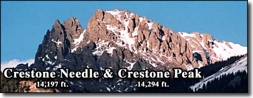
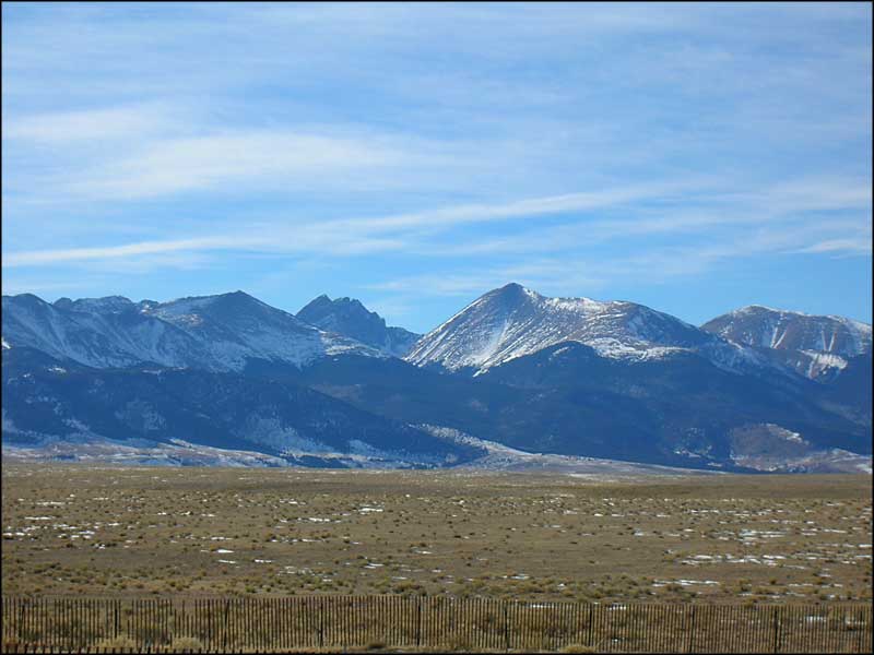
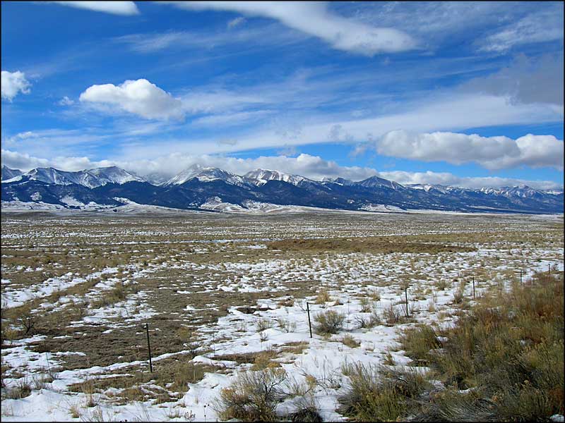
Crestone Needle and Crestone PeakSangre de Cristo Mountains |
|||||||||||||||
|
|
|||||||||||||||
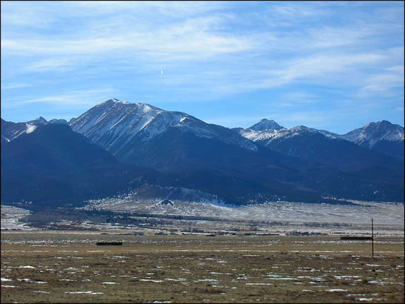
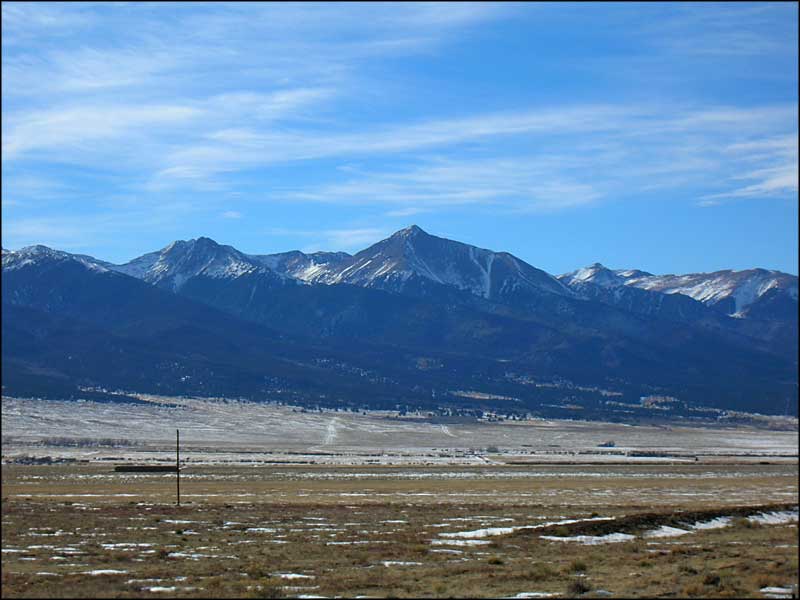
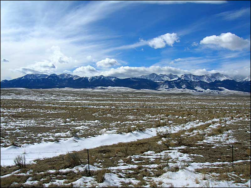
 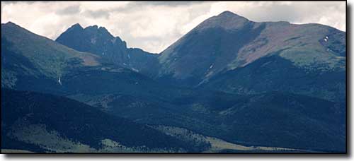 The Crestones & Mt. Humboldt, taken from south of Westcliffe |
|||||||||||||||
|
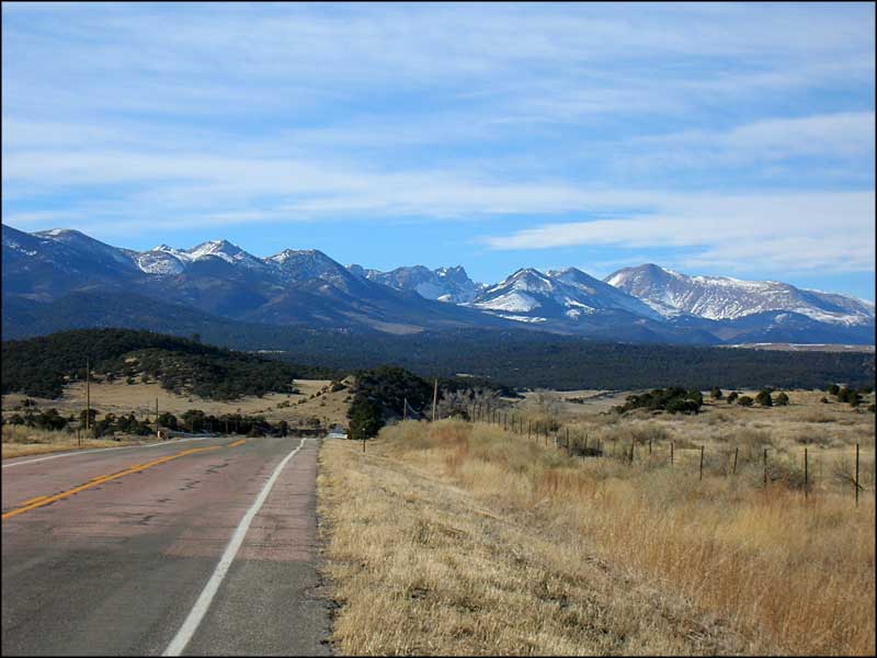
The Crestones are among the most challenging mountains to climb in Colorado, the Needle being a bit harder than the Peak. They are also among the most popular with folks who like technical climbs. Humboldt is reputed to be a "walk-up." All of them can be reached by a forest service road leading 5 miles in to the South Colony Lakes area, southwest of Westcliffe. This road is also reputed to be an axle breaker, surpassed in its' ability to do damage only by the Lake Como Road going up Mt. Blanca. There's some 3,600 feet of elevation gain between South Colony Lakes and the summit of Crestone Peak. You can hike/climb for several miles around the mountains to get there or you can go straight to the 2,000 foot rock wall and have some fun. There are also trails leading from the Crestone area on the west side of the Sangres that make certain climbs easier. Most of the 14ers here are in the San Isabel National Forest, although the summits of Kit Carson Peak and Challenger Point are on what used to be the Baca Grande, which is now owned by the US Department of the Interior and some of which is to be incorporated into the Rio Grande National Forest. |
|||||||||||||||
| Clicking on any of these photos will open a new window or new tab in your browser and bring you a larger version of that photo. |
|||||||||||||||
| |||||||||||||||
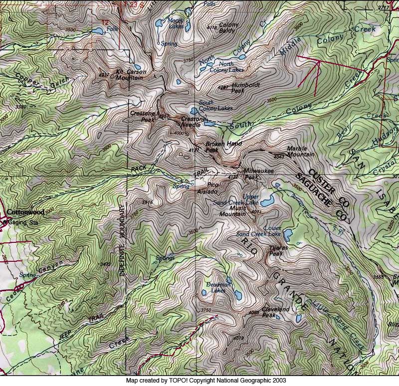
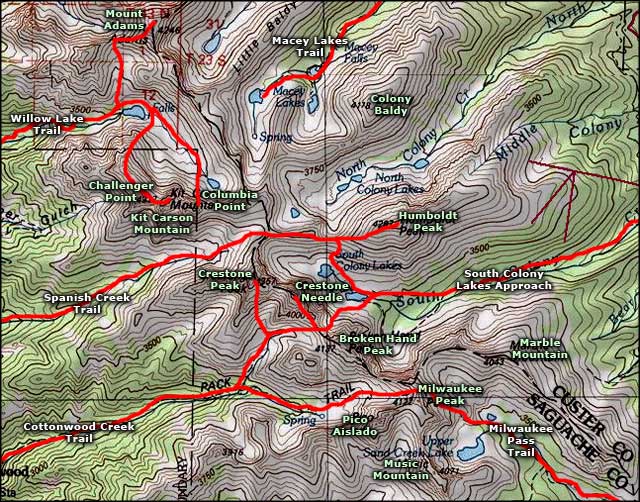 Crestone Peak-Crestone Needle area map |
|||||||||||||||
|
|
|||||||||||||||
Crestone Peaks Related Pages
Crestones from the West - Kit Carson Peak - Crestones Topo Map
Panoramic Photos - Custer County - Panoramas of the Sangres in Winter San Isabel National Forest PagesColorado Pages
Towns & Places - Scenic Byways - State Parks - BLM Sites - History & Heritage Ski & Snowboard Areas - Photo Galleries - Colorado Mountains - Scenic Railroads Unique Natural Features - Wilderness Areas - Outdoor Sports & Recreation Colorado's National Forests - National Wildlife Refuges - Colorado's National Parks |
|||||||||||||||

|
|||||||||||||||
| Index - Arizona - Colorado - Idaho - Montana - Nevada - New Mexico - Utah - Wyoming National Forests - National Parks - Scenic Byways - Ski & Snowboard Areas - BLM Sites Wilderness Areas - National Wildlife Refuges - National Trails - Rural Life Advertise With Us - About This Site - Privacy Policy |
|||||||||||||||
| Photos courtesy of Sangres.com, CCA ShareAlike 3.0 License. Map courtesy of National Geographic Topo! Text Copyright © by Sangres.com. All rights reserved. | |||||||||||||||


