 |
Slumgullion Pass & Slumgullion Earthflow |
|
|
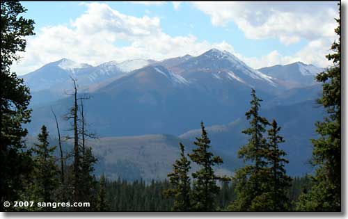 Red Mountain from the summit of Slumgullion Pass |
|
|
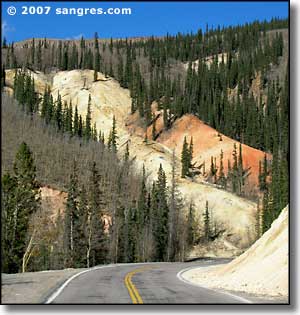
The Slumgullion Earthflow and Slumgullion Pass (11,361') are located on Highway 149, the Silver Thread Scenic Byway, between Creede and Lake City. The Pass is not really a pass but is actually a low point on a ridge where it is possible to drop down to the Lake Fork of the Gunnison River. The earthflow, or mudslide, began some 700 years ago when, lubricated by heavy rains, the weak volcanic tuff and breccia on the southern flank of Mesa Seco slumped several miles down the steep mountainside. The photo to the left shows some of it. About 350 years ago, a second earthflow started from the top of the mountain. The new flow is still moving, sometimes as much as twenty feet in a year. The first flow was so large and cataclysmic, it blocked the Lake Fork of the Gunnison River and created Lake San Cristobal, Colorado's second largest natural lake. |
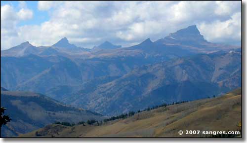 Wetterhorn, Matterhorn and Uncompahgre, from the summit of Slumgullion Pass 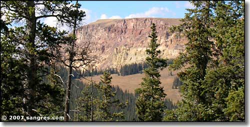 Mesa Seco, where the Slumgullion Earthflow began its' downward slide 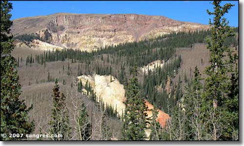 The Earthflow from below 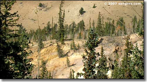 A more active section of the Earthflow 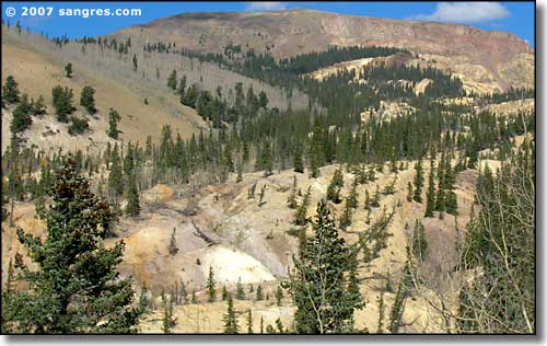 Another view from below 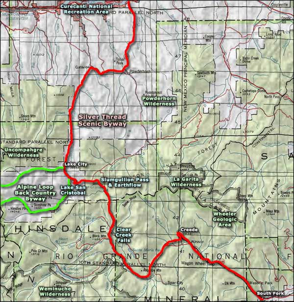 Slumgullion Pass and Earthflow area map |
|
|
Slumgullion Pass/Earthflow Related Pages
South Fork - Creede - Lake City - Lake San Cristobal - Wheeler Geologic Area
Silver Thread Scenic Byway - Silver Thread History - La Garita Wilderness Alpine Loop Back Country Byway - Curecanti National Recreation Area Rio Grande National Forest - Gunnison National Forest - Weminuche Wilderness Uncompahgre Wilderness - Powderhorn Wilderness Colorado Pages
Towns & Places - Scenic Byways - State Parks - BLM Sites - History & Heritage
Ski & Snowboard Areas - Photo Galleries - Colorado Mountains - Scenic Railroads Unique Natural Features - Wilderness Areas - Outdoor Sports & Recreation Colorado's National Forests - National Wildlife Refuges - Colorado's National Parks |
 |
| Index - Arizona - Colorado - Idaho - Montana - Nevada - New Mexico - Utah - Wyoming National Forests - National Parks - Scenic Byways - Ski & Snowboard Areas - BLM Sites Wilderness Areas - National Wildlife Refuges - National Trails - Rural Life Sponsor Sangres.com - About Sangres.com - Privacy Policy - Accessibility |
| Photos courtesy of Sangres.com, CCA ShareAlike 3.0 License. Text Copyright © by Sangres.com. All rights reserved. |