 |
Red Rock Canyon Scenic Byway
|
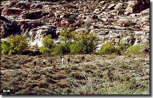 In Red Rock Canyon National Conservation Area |
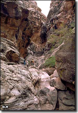
The Red Rock Canyon Back Country Byway is a 13-mile long one-way paved loop road that is shared with bicyclists. The route is generally open from 6 am to 5 pm every day with longer hours in the summer. The route passes through some spectacular scenery in Red Rocks Canyon with parking allowed at designated pullouts and parking areas. These designated stopping points also allow reasonably easy access to sightseeing, photography and hiking trails. You'll find red and cream colored sandstone formations, desert wildlife, petroglyphs and waterfalls along the route. Be careful, though, there may be rocks and debris that have fallen on the roadway from the overhanging cliffs... Red Rock Canyon Road is the Scenic Byway that you'll use to access the Red Rock Canyon Back Country Byway. Most of the length of this route is within the boundaries of the Red Rock Canyon National Conservation Area. It's along this route that you'll find Spring Mountain Ranch State Park. Red Rock Canyon National Conservation Area is a fee demonstration project where a $5 fee per vehicle is collected at the entrance to the byway. All money collected remains at the site and is used for improvements. |
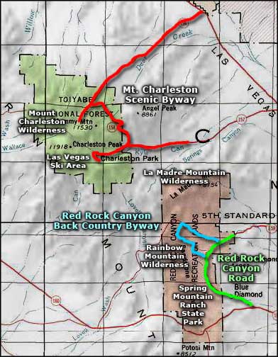 Red Rock Canyon Road area map |
|
|

|
| Index - Arizona - Colorado - Idaho - Montana - Nevada - New Mexico - Utah - Wyoming National Forests - National Parks - Scenic Byways - Ski & Snowboard Areas - BLM Sites Wilderness Areas - National Wildlife Refuges - National Trails - Rural Life Advertise With Us - About This Site - Privacy Policy |
| Photos of Red Rock Canyon National Conservation Area courtesy of the Bureau of Land Management. Area map courtesy of National Geographic Topo! Text Copyright © by Sangres.com. All rights reserved. |