 |
Welcome Creek Wilderness |
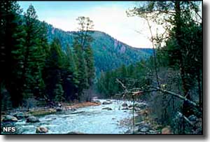
The 28,135 acres of the Welcome Creek Wilderness are about 25 miles southeast of Missoula in the Rock Creek drainage on the northeast side of the Sapphire Mountains. This is an area that sees hikers, hunters and a few fishermen but almost no backpackers because you can't find a level spot to pitch a tent: these mountains are too steep and the valleys too narrow and uneven. There are some open grassy areas on some of the south-facing slopes but use of them is defeated by the steepness. The land is heavily timbered and extremely rocky and rough. There's about 25 miles of trails but most are too steep to even allow horses. The main travel route is a brushy trail along Welcome Creek that crosses the Wilderness from southeast to northwest for about 7 miles (although Welcome Creek actually flows south and east to exit the mountains). There's good trout fishing in the streams but there are no lakes. Placer gold was found along Welcome Creek in 1888. The mining heyday didn't last very long but one of the largest gold nuggets found in Montana (1.5 pounds) was found here. A number of hand-hewn log cabins were built in those days and after the rush was over, many of them became hideouts for fugitives from the law. Maybe a dozen crumbling remains still exist, hidden in places you would not expect. |
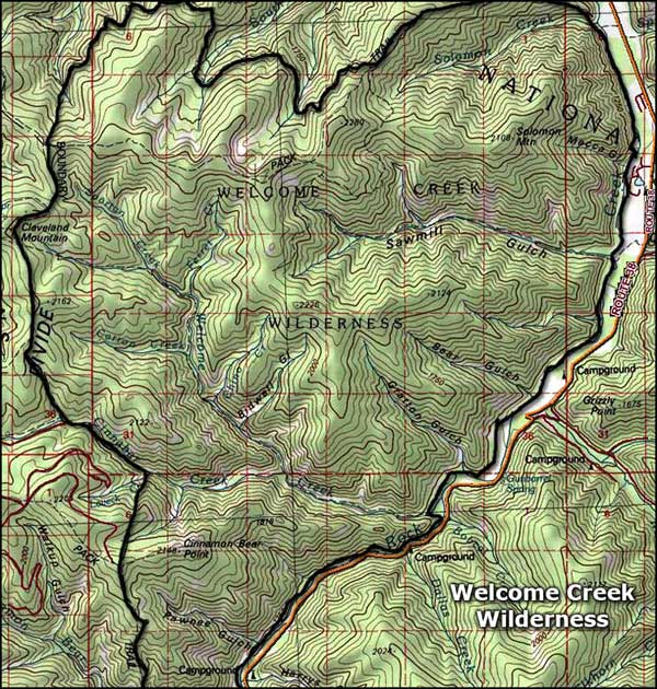 Welcome Creek Wilderness map |
|
|
 |
| Index - Arizona - Colorado - Idaho - Montana - Nevada - New Mexico - Utah - Wyoming National Forests - National Parks - Scenic Byways - Ski & Snowboard Areas - BLM Sites Wilderness Areas - National Wildlife Refuges - National Trails - Rural Life Advertise With Us - About This Site - Privacy Policy |
| Upper left photo of the Welcome Creek Wilderness courtesy of the National Forest Service. Map courtesy of National Geographic Topo! Text Copyright © by Sangres.com. All rights reserved. |