 |
Selway-Bitterroot Wilderness |
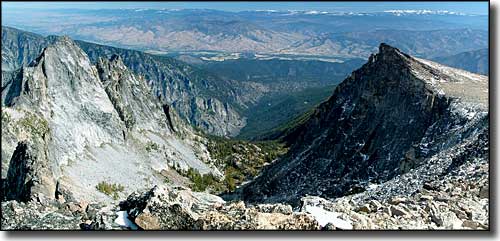 The view northeast from the summit of Trapper Peak |
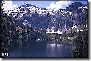
Of the 1,340,502 acres of the Selway-Bitterroot Wilderness, only about 251,443 acres are in Montana, the rest being in Idaho. The Selway-Bitterroot Wilderness is the 3rd largest wilderness in the 48 contiguous states, exceeded in size only by the Frank Church-River of No Return Wilderness in Idaho and the Death Valley Wilderness in California. Selway-Bitterroot is separated from the Frank Church-River of No Return Wilderness by a 600-foot wide corridor along the Nez Perce Trail on an unimproved dirt road (called the Magruder Corridor - also the route taken by Chief Joseph and his Nez Perce during their run for the freedom of Canada in 1877). The Montana section of Selway-Bitterroot lies east of the top ridgeline of the Bitterroot Mountains. This countryside of high, glacier-carved ridges dropping into deep, vertical-walled valleys is one of the most rugged mountainous areas on Earth. As barren as the high ridges and peaks are, the valleys are densely forested, with streams and many alpine lakes that offer world-class trout fishing. The Selway elk herd is huge, but there are also lots of moose, deer, mountain lion and black bear. There are many miles of hiking trails on the Montana side of the Selway-Bitterroot Wilderness but most of them are very rugged and haven't been maintained in years. The only trail that seems to get regular maintenance is the Divide Trail, which follows the Bitterroot Divide for about 7 miles north of Nez Perce Pass. There are also large parts of this wilderness that don't have even unmaintained trails. |
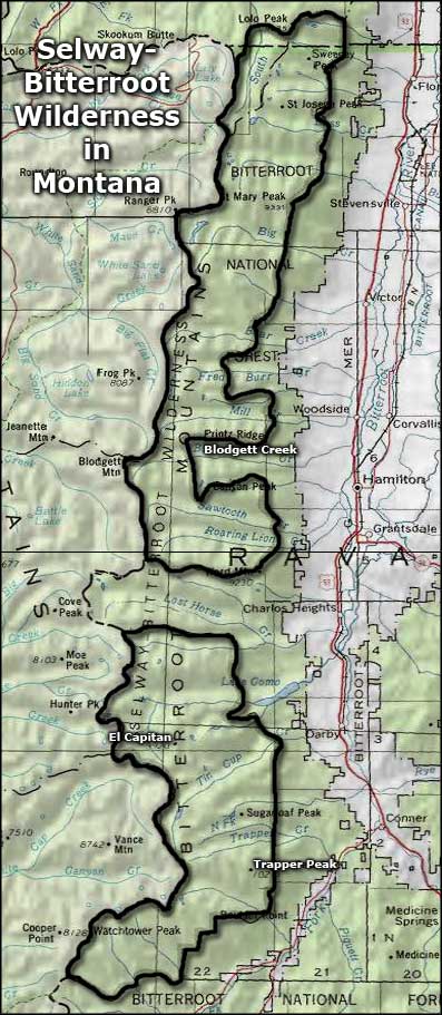 Area map of the Selway-Bitterroot Wilderness in Montana |
|
|
 |
| Index - Arizona - Colorado - Idaho - Montana - Nevada - New Mexico - Utah - Wyoming National Forests - National Parks - Scenic Byways - Ski & Snowboard Areas - BLM Sites Wilderness Areas - National Wildlife Refuges - National Trails - Rural Life Advertise With Us - About This Site - Privacy Policy |
| Upper left photo of the Selway-Bitterroot Wilderness is courtesy of the National Forest Service. Map courtesy of National Geographic Topo! Text Copyright © by Sangres.com. All rights reserved. |