 |
St. Regis-Paradise Scenic Byway |
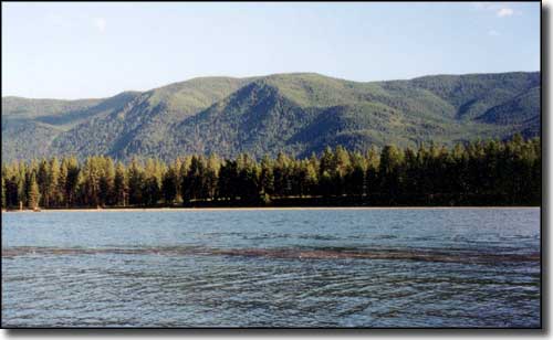 Clark Fork River near Thompson Falls |
|
The St. Regis-Paradise Scenic Byway is a 30-mile drive in the canyon of the Clark Fork River across a section of the Lolo National Forest in the Couer d'Alene Mountains. You'll find spacious, rolling flats and steep canyon walls as the road meanders through the canyon, criss-crossing the river several times. From the I-90, this route on Montana Highway 135 is also a bit of a short-cut to the National Bison Range, Flathead Lake and Glacier National Park. The Clark Fork River in this area is an excellent fishing stream, and whitewater rafters and kayakers like the river's action a lot, too. As this is the Lolo National Forest, hiking, mountain biking, horseback riding, backpacking, camping and other recreational opportunities are around every bend in the road. In the winter, this area is a Mecca for snowmobilers and backcountry skiers alike. In your journey, you may see some of the elk, mule deer, white-tailed deer or even bighorn sheep that live here. |
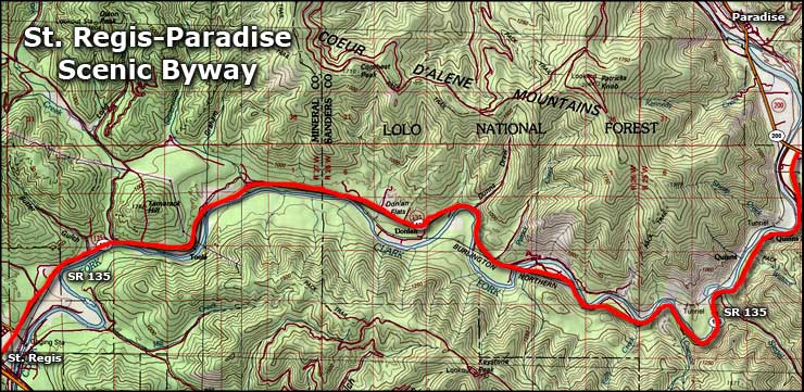 Area map of the St. Regis-Paradise Scenic Byway |
|
|
 |
| Index - Arizona - Colorado - Idaho - Montana - Nevada - New Mexico - Utah - Wyoming National Forests - National Parks - Scenic Byways - Ski & Snowboard Areas - BLM Sites Wilderness Areas - National Wildlife Refuges - National Trails - Rural Life Advertise With Us - About This Site - Privacy Policy |
| Photo of Clark Fork River © 2003 by K. Armstrong, via byways.org. Map courtesy of National Geographic Topo! Text Copyright © by Sangres.com. All rights reserved. |