 |
Lake Koocanusa Scenic Byway |
 |
|
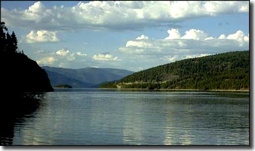
Lake Koocanusa was created by the building of Libby Dam on the Kootenai River in northwestern Montana. The Lake Koocanusa Scenic Byway travels for 67 miles between Libby and Eureka, mostly beside the lake on Montana Highway 37, a year-round route. Montana 37 travels the eastern side of the lake but there is an alternate (paved, 2-lane, FDR #228) route along the western side of the lake that is only available from late spring to early fall. The scenic byway only covers the lower half of the lake. The Kootenai River took a few million years cutting this very scenic but narrow gorge into the surrounding mountains. Then humans built a dam across the river and filled the lower part of the gorge, making a lake some 93-miles-long that crosses the border into Canada. Lake Koocanusa offers boating and some excellent fishing opportunities (rainbow trout, salmon, Rocky Mountain whitefish). Camping, mountain biking, backpacking and hiking are available in the surrounding Kootenai National Forest. This is also an area with a lot of deer, elk, moose, bear and bighorn sheep, with eagles and ospreys sometimes seen nesting in the upper dead tree branches above the water. With the Purcell Mountains to the west, the Salish Mountains to the east and the Cabinet Mountains to the south, there is no shortage of incredible mountain and lake vistas along this Scenic Byway. |
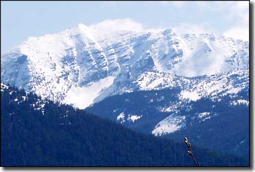 Springtime in the Cabinet Mountains above Lake Koocanusa 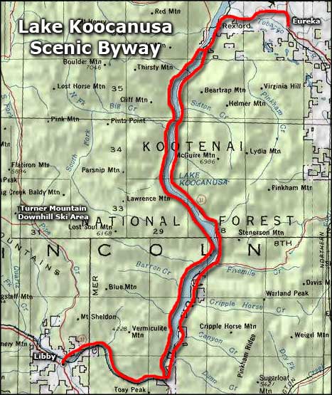 Lake Koocanusa Scenic Byway area map |
|
|
 |
| Index - Arizona - Colorado - Idaho - Montana - Nevada - New Mexico - Utah - Wyoming National Forests - National Parks - Scenic Byways - Ski & Snowboard Areas - BLM Sites Wilderness Areas - National Wildlife Refuges - National Trails - Rural Life Advertise With Us - About This Site - Privacy Policy |
| Photos of Lake Koocanusa and of the Cabinet Mountains courtesy of Dusti Thompson. Map courtesy of National Geographic Topo! Text Copyright © by Sangres.com. All rights reserved. |