 |
Acton Recreation Area |
 |
|
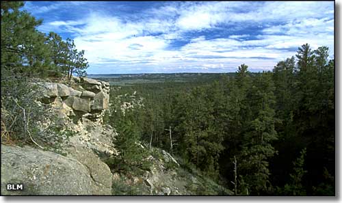
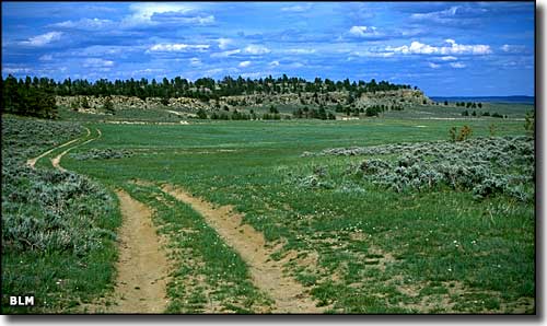
The Acton Recreation Area is about 3,800 acres of diverse landscape about 18 miles north of Billings. There's a lot of wildlife in this area of sandstone bluffs, steep drainages, minor badlands, eroded shale and scattered Ponderosa forest. In addition to the excellent opportunities for hiking, mountain biking, horseback riding, camping and hunting (in season), there's about 6.6 miles of roads designated for motorized use. The Acton Recreation Area is part of the Hoskins Basin Archaeological District, an area that contains the remains of distinctive cribbed and conical aboriginal wooden dwellings. The cribbed wooden dwellings are found only in the area of south-central Montana and northern Wyoming. The conical wooden dwellings are spread around the countryside a bit more but their existence is being slowly erased by time and modern human impact. As the passage of time and their use as fence posts and firewood has destroyed many of these aboriginal dwellings, the Acton Recreation Area is one of the few places where both types of dwelling can still be found. To protect these archaeological sites (and the wildlife habitat), no off-road motorized vehicle use is allowed. Except for closure due to fire danger or wet and muddy conditions, Acton Recreation Area is open year-round, just be careful during hunting season. There are no fees involved. To get to the Acton Recreation Area, between mile markers 18 and 19 on SR 3 north of the town of Acton, turn right (east) onto Oswald Road. Go 6.5 miles to Heag Road and turn right again. The parking lot is about 2.5 miles from there. |
 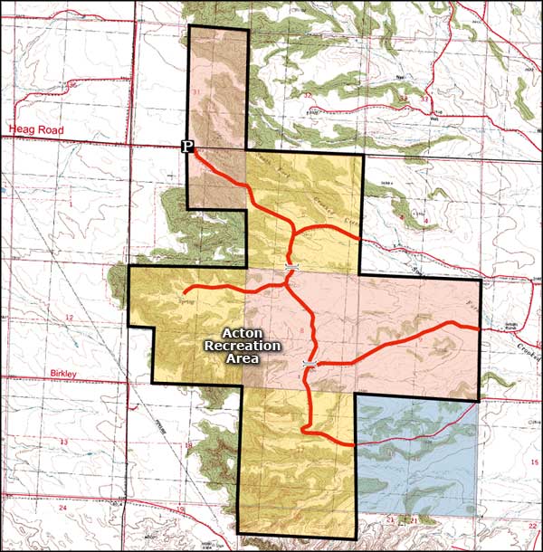 Map of the Acton Recreation Area 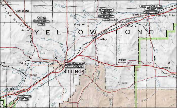 Acton Recreation Area area map |
|
|
 |
| Index - Arizona - Colorado - Idaho - Montana - Nevada - New Mexico - Utah - Wyoming National Forests - National Parks - Scenic Byways - Ski & Snowboard Areas - BLM Sites Wilderness Areas - National Wildlife Refuges - National Trails - Rural Life Advertise With Us - About This Site - Privacy Policy |
| Photos and map of the Acton Recreation Area are courtesy of the Bureau of Land Management Area map courtesy of National Geographic Topo! Text Copyright © by Sangres.com. All rights reserved. |