 |
Wildlife Canyon Scenic Byway |
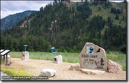 Gallagher Flats Wildlife Viewpoint, Wildlife Canyon Scenic Byway |
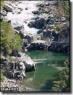
Talk about a beautiful drive, the Wildlife Canyon Scenic Byway is 33 miles long, up the canyon of the South Fork of the Payette River: wild and turbulent water, herds of elk, mule deer and white-tailed deer, wild turkeys, chukars, golden eagles, ospreys, bears, cougars, wolves... all in a canyon of forest and rock cut deeply into the central Idaho mountains. This route follows the Banks-Lowman Road between Idaho Highway 55 (Payette River Scenic Byway) and Idaho Highway 21 (Ponderosa Pine Scenic Byway). If you do it as a loop from Boise figure on 3 hours driving time, complete. If you bring your tent, camera, fishing rod, well.... Many folks come to the South Fork of the Payette for the whitewater adventures offered. Some of the rapids on the river are rated at Class IV so this trip is not for the inexperienced or the faint of heart. Some of the river is like Big Falls (the small photo here to the right) and can only be passed by portaging around the zone. This area sees lots of rafts and kayaks in season. There are several campgrounds spread through the canyon, some with natural hot springs close by. Boise National Forest offers many trails in the area, many of which are also used by cross-country skiers and snowmobilers in the winter. In the middle of the route you'll come to the Danskin river-access point. There's a 5-mile section of road here that is in the heart of prime winter habitat for elk. You may find hundreds of them at a time in the area during winter and spring. The road is paved all the way and offers several turnouts where you can get out, stretch, enjoy the scenery, eat lunch, catch some trout, watch the acrobatics of kayakers in the Class IV whitewater... and there are several historic towns along the way, left over from the homesteaders and the big logging and mining days. The road actually follows the route of an old stage coach relay line and you'll find remnants of that, too. Archaeologists have found evidence at the Deadwood Campground (whitewater access point, rest area, Julie Creek trailhead) of Native Americans using the site regularly between 534 and 731 CE, and again between 1019 and 1221 CE. |
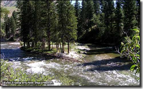 The Danskin river access point on the South Fork of the Payette River 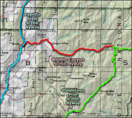 Wildlife Canyon Scenic Byway area map |
|
|
 |
| Index - Arizona - Colorado - Idaho - Montana - Nevada - New Mexico - Utah - Wyoming National Forests - National Parks - Scenic Byways - Ski & Snowboard Areas - BLM Sites Wilderness Areas - National Wildlife Refuges - National Trails - Rural Life Advertise With Us - About This Site - Privacy Policy |
| Photos courtesy of the Idaho Transportation Department. Area map courtesy of National Geographic Topo! Text Copyright © by Sangres.com. All rights reserved. |