 |
St. Joe River Scenic Byway |
 The St. Joe River |
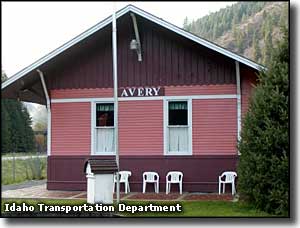
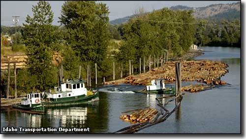
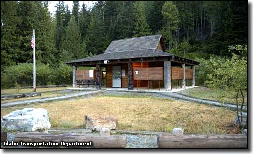
The St. Joe River Scenic Byway is an 89-mile drive through the forests and mountains of northern Idaho starting from the intersection of Idaho Route 3 and Forest Service Road 50 in St. Maries. The byway follows FS 50 east for 75 miles to the junction with FS 218, then goes left on FS 50 (Liitle Joe-Gold Creek Road) and climbs 14 miles into the Bitterroot Mountains to the Idaho-Montana border. The route is paved all the way but in winter it is not plowed beyond Avery (47 miles from St. Maries). In the winter, from Avery on this is a groomed snowmobile route. St. Maries was established primarily as a logging town and timber has been the main business for many years. The vast forests east of town have provided plenty of timber and the majority of that timber has made it to the sawmills in St. Maries by floating down the river. The timber business was good when shipping was done on steamboats that plied Lake Couer d'Alene but really picked up when the railroad finally arrived in the early 1900's. The route of the St. Joe River Scenic Byway is along the old railroad grade east, over roads built by the logging companies in the early twentieth century. Most of the St. Joe River Scenic Byway travels along beside the St. Joe River (of course). The first section to St. Joe City sees the river reasonably deep and wide. Beyond St. Joe City the river gets shallower with lots of rapids. If you're an angler, you'll have to share the blue ribbon trout fishery with the whitewater rafters in season. You'll pass by the Marble Creek historic site with a nice picnic area and then shortly arrive in Avery. You might want to stop at Marble Creek and check out the museum/interpretive center with its exhibits of "the way it was:" the early days of logging in remote areas of Idaho. Logging in this area began in the early 1900's but there was no road until the Civilian Conservation Corps built one in the 1930's. The Milwaukee Road did build a railroad line through here around 1917, and the Olympian Hiawatha passenger train between Chicago and Seattle used this for its main route. There's a place east of Marble Creek where you can turn south on Forest Service Roads 321 and 3357 and go to Hobo Cedar Grove. This is an incredible 240-acre site with ancient western red cedars towering above a lush carpet of green ferns. There is an interpretive trail available there to lead through this world-class botanical site filled with virgin timber up to three thousand years old. 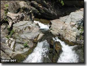
Avery has a ranger station and was formerly a railroad depot. The depot has been refurbed into a museum and offers a refurbished sleeper/diner car as part of the museum exhibits. Avery was first homestead by Sam Williams in 1894. Little did he know that the Milwaukee Road would turn his little place into a major division point where the trains left off their electric locomotives and switched to steam or diesel for the trip over the mountains. Just above Avery is where the Hiawatha Rail-Trail bike route begins, heading north on the abandoned railroad bed into the Bitterroots and crossing under the range through the 1.6-mile St. Paul Pass Tunnel at East Portal. Also at Avery is where the St. Joe Wild and Scenic River begins, right beside the byway and still heading east (upstream). Beyond Avery, the road continues deep into the forest until you reach the foot of the Gold Creek-Little Joe Road. The Gold Creek-Little Joe Road climbs north up the side of the Bitterroot Mountains to cross Gold Summit and descend into Montana. The St. Joe River Scenic Byway terminates at the top of Gold Summit. For many years, the lower St. Joe has been a primary route for tug boats guiding huge rafts of cut logs downstream to sawmills near St. Maries. The St. Joe River is also rated as the highest navigable river in the world. |
 The Marble Creek Interpretive Center 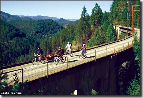 Biking on the Hiawatha Rail-Trail 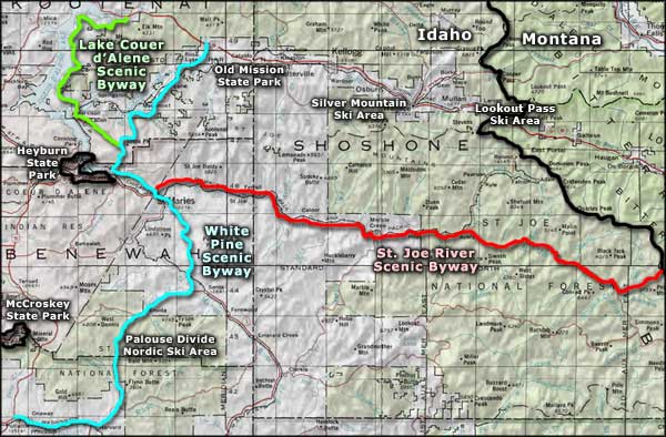 St. Joe River Scenic Byway area map |
|
|
 |
| Index - Arizona - Colorado - Idaho - Montana - Nevada - New Mexico - Utah - Wyoming National Forests - National Parks - Scenic Byways - Ski & Snowboard Areas - BLM Sites Wilderness Areas - National Wildlife Refuges - National Trails - Rural Life Advertise With Us - About This Site - Privacy Policy |
| Photos courtesy of the Idaho DOT and Idaho Tourism. Area map courtesy of National Geographic Topo! Text Copyright © by Sangres.com. All rights reserved. |