Desert to Tall Pines Scenic Road

The Sierra Ancha Mountains

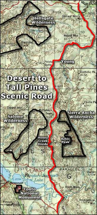
The 76-mile-long Desert to Tall Pines Scenic Road follows Arizona Highway 288 from the intersection between Globe and Roosevelt on Arizona Highway 188 north through the town of Young to its end at Arizona Highway 260, just west of Forest Lakes. This area is what cowboys would call "the high lonesome country," partly because the lullaby howling of coyotes at night wouldn't ever be interrupted by the sound of a passing truck or airplane.
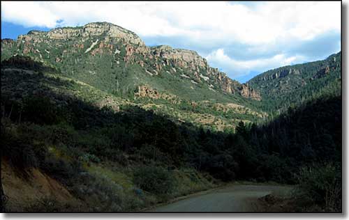
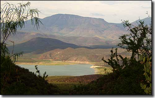
Coming from the south, about 15 miles north of Miami Gardens on State Route 188 you'll come to the turnoff for SR 288. Turn to the north and follow the paved road as it makes its way down the side of the Salt River Mountains to cross the Salt River on a one-lane bridge. Then the road is reasonably flat while it makes its way around the edge of the valley with Theodore Roosevelt Lake off to the west. Once you're well northeast of the lake, the road begins its long, winding climb into the Sierra Ancha (Spanish for wide range) Mountains. As you're climbing, you'll come across a couple of pullouts with some great views over Theodore Roosevelt Lake and into the Four Peaks Wilderness and Mazatzal Mountains to west. A little further up and the Sierra Ancha Wilderness will be to the east with the Salome Wilderness to the west. Somewhere in this area is where the pavement ends (although there have been rumors that the state is going to pave the whole route).
Shortly you'll cross the high point on the whole road: Honey Creek Divide. About a mile past that spot, you'll come to Forest Road 487 on the right (east side). That 4WD road heads up through the canyon near Workman Creek Falls and on to the lookout atop Aztec Peak (7,694'), highest point in the Sierra Ancha's. If you have problems with heights or hairpin curves on narrow roads that drop off sheer cliffs... you may prefer to hike that road. The view is nothing short of incredible, and you'll find these woods are overflowing with big game (mountain lions, mule deer, black bears). In the late 1970's, the famous environmental activist Edward Abbey spent 3 summers on top of Aztec Peak, working as a fire lookout. I think that was a life-changing adventure for him. There's a trail named for Abbey now that leads from the lookout tower to about 1/2 mile above Workman Creek Falls.
If you stayed on the main road, you'll realize soon enough that now you're up on a large plateau area with deep canyons cut into the ground for miles all around. A few more miles on the road and you'll be in Young. Young may look like something out of the late 1800's but there are 2 restaurants and a single gas station in town. The phones work and there is electric power.
This is the area of the famous Pleasant Valley War of the late 1880's. There was a problem here between the big cattle ranchers and the small homesteaders and sheep herders. There was a big cattle rancher named Stinson who started the cattle rustling accusations but most of the shooting took place between the Tewksburys and the Grahams. Before it was over, the shooting had spread as far away as Tempe and between 19 and 35 people died (both the Tewksbury and Graham familes were essentially wiped out). Just before he died of a bullet wound himself, Tom Graham sold his ranch and cattle to William Young who established the town that still carries his name.
At Young, Arizona Highway 288 becomes Forest Road 512 and the dirt thoroughfare continues its journey north. A few twists and switchbacks lead up onto the edge of the Naegelin Rim where you'll find the Colcord Mountain Lookout. Stop and enjoy the view back over the Tonto Basin, the countryside through which you've been driving for probably four hours now. From there it's just a few more miles through the dense Ponderosa forest on top of the Mogollon Rim to the intersection with Arizona Highway 260. Go east to Show Low or west to Payson.

Roosevelt Lake, at the southern end of the Desert to Tall Pines Scenic Road
