 |
Owyhee Uplands Back Country Byway |
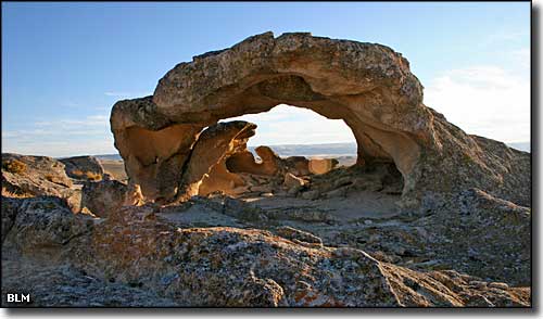 An oolite above Shoofly Canyon along the Owyhee Uplands Back Country Byway |
The Owyhee Uplands Back Country Byway is one of those roads you want to drive in the summer, with a full gas tank and extra food and water. The eastern end of the byway is at Grand View, the western end at Jordan Valley, Oregon, about 103 miles away, not "as the crow flies" but as this gravel road makes its way around the southern end of the Owyhee Mountains. In between there are lots of sights, lots of wildlife and some good camping but not much else: deep river canyons, dry mountains, desert areas, small riparian zones, abandoned mining settlements... Most of the road is gravel and about 1.5 lanes wide at best. The route is usually impassable from late October through early May because of snow. Depending on how recent and how severe rainfall might be, the road can be impassable at almost any time of year. The best times to travel: early summer and fall. The Owyhee Uplands Back Country Byway is primarily a Bureau of Land Management route. There is one developed campground about 30 miles east of Jordan Valley, Oregon, at the North Fork Recreation Site. There is also a developed picnic area at Poison Creek. Other than that, there are no amentities or services along the entire route. There are pullouts, interpretive panels and kiosks in a couple places. The Owyhee Uplands are one of the last remaining large examples of a steppe-sagebrush ecosystem in North America. Some areas also sport juniper woodlands with some grizzled and twisted veterans up to 500 years old. As dry and barren as it might look to the casual observer, there are more than 180 species of birds and mammals that call the Uplands home. Most of this countryside was formed and shaped by volcanic forces that began about 17 million years ago and ended about 2 million years ago. Since then, the countryside has been eroded into some great canyons, big mountains and a few odd shapes... This is also high desert: barren, dry and easily made impassable by a bit of moisture. But if you're willing to dare it, this is some gorgeous countryside that you just might have all to yourself. Starting from Grand View on the Snake River, you're going to be driving BLM gravel road the whole way. About 8 miles south of Grand View you'll come to the abandoned Turmes Ranch. Settled in the 1880's Turmes Ranch was once upon a time a traveler's way station, back when this area was being scoured by gold and silver prospectors. Beyond Turmes Ranch, you'll be heading up Shoofly Canyon and into the real Owyhee Uplands. This is a large area of desert with steep red-rock walls rising above streambeds cut deep into the ground. The steep, stark Owyhee Mountains rise to the north and in between are huge areas of scrub, sagebrush and wildflowers. A lot of folks think this area is what the West is supposed to look like and if you're one of those, you're in for a treat. Passing by some fantastical rock shapes and over deep canyons you'll eventually come to the (primitive) North Fork Campground on the North Fork of the Owyhee River. This is about 31 miles south of the end of the byway at Jordan Valley, OR. From the campground, the route runs close to the rim of the North Fork Canyon and offers some incredible views of the Owyhee Mountains rising in the background above that canyon dropping below. Apparently, this area sees lots of photographers pulled over on the side of the road, doing their thing. Jordan Valley has limited services available but you will find pavement there (US Highway 95), and if you go right (north), it's about 50 miles back to "civilization." The BLM says that normally, a typical passenger car will do fine along the road, just look out for inclement weather. You also want to be well-equipped with plenty of food, water, clothing, warm bedding, tent and maybe even an extra spare tire. Do not count on your cell phone to do anything other than its best impression of a paper weight in this countryside. In the Owyhee Uplands, about 500,000 acres of the countryside has been set aside as designated Wilderness, with another 199,000 acres recently released from the category of "Wilderness Study Area." A large part of that land is along the deep canyons that the larger streams and rivers flow in but there are several upland areas along the Owyhee Uplands Back Country Byway that also carry the Wilderness designation. Along the route you'll find several trailheads just off the road that give access to places like Little Jacks Creek, Pole Creek and North Fork Owyhee Wildernesses. |
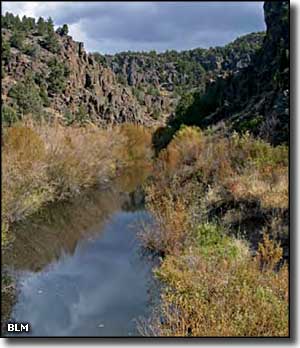
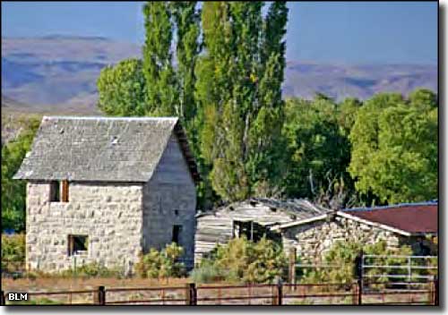 The abandoned Turmes Ranch 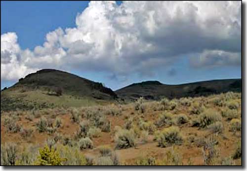 A typical view along the Owyhee Uplands Back Country Byway 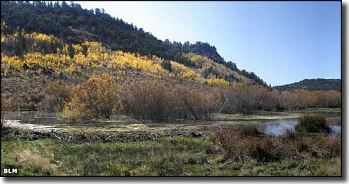 A riparian area along the Owyhee Uplands Back Country Byway 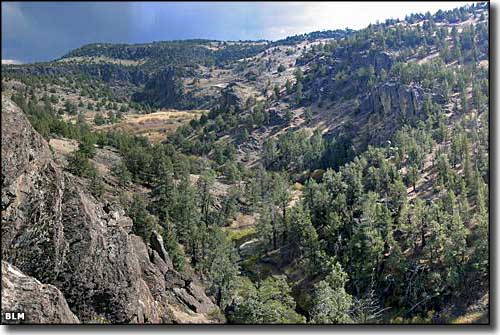 A view into the North Fork Owyhee Wilderness 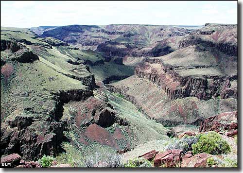 A view into Little Jacks Creek Wilderness 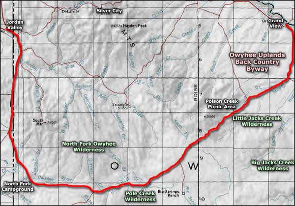 Owyhee Uplands Back Country Byway area map |
|
|
 |
| Index - Arizona - Colorado - Idaho - Montana - Nevada - New Mexico - Utah - Wyoming National Forests - National Parks - Scenic Byways - Ski & Snowboard Areas - BLM Sites Wilderness Areas - National Wildlife Refuges - National Trails - Rural Life Advertise With Us - About This Site - Privacy Policy |
| Photos courtesy of the Bureau of Land Management. Area map courtesy of National Geographic Topo! Text Copyright © by Sangres.com. All rights reserved. |