 |
Lewis and Clark Back Country Byway |
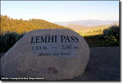 At the summit of Lemhi Pass |
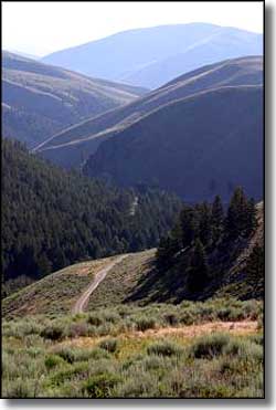
Lewis & Clark stood at the summit of Lemhi Pass one day in 1805 and watched as their dream of an easy Northwest Passage fell away, lost in the views of the Bitterroot and Lost River Mountain Ranges and the immense Salmon River drainage below. Lemhi Pass sits on the Continental Divide, and in all directions as far as the eye can see, the countryside has hardly changed since that fateful day in 1805. Today's Lewis & Clark Back Country Byway begins in the town of Tendoy at the intersection with Idaho Highway 28 (the Sacajawea Historic Byway). From Tendoy the route climbs eastward to the summit of Lemhi Pass. There's something about that view down over the Salmon River and the Lost River and Rocky Mountain Ranges... it hasn't really changed any from when they first looked down back in 1805. At the top of Lemhi Pass is where you'll find the Continental Divide National Scenic Trail. Once at the summit of Lemhi Pass, the main route of the Back Country Byway then heads northward along that upper ridge of the Bitterroots before dropping back down to the west and reapproaching Tendoy from the north. Most of this gravel route used to lead to mines high in the mountains, but those mines are closed now and the roads remain, sort of. You want to be sure you've got lots of clearance under your axles. 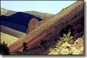
If you need a break along the way you can always stop and check out the hot springs at Sharkey Creek. The BLM also has a tent and trailer campground (with toilets but no drinking water) at milepost 33 in the Agency Creek drainage, about 4 miles up the hill from Tendoy on Agency Creek Road. I say "developed" campground but it's really only four primitive campsites with vault toilets nearby. There's no fees involved and the general use season runs from June through September. There is an interpretive kiosk at the campground with some cultural and historic info about the area. This is a 39-mile, single lane gravel loop that is usually closed by snow from November into June. The route is maintained and officially doesn't require either 4WD or high clearance but you never know... I don't know that I'd try it in any vehicle with less than 8 inches of clearance. I also wouldn't want to be out there with 2WD on a rainy day. Best time to try your luck: mid-summer to early fall, unless you're on a snowmobile: once there's enough snow on the ground this is a popular route among the snowmobile set and is usually kept groomed all winter. They officially recommend allowing 3 hours to complete this drive. |
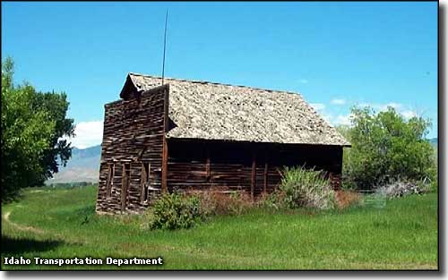 The old stage stop in Tendoy 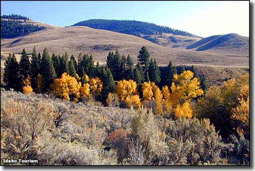 Just up the hill above Tendoy on the Lewis & Clark Back Country Byway 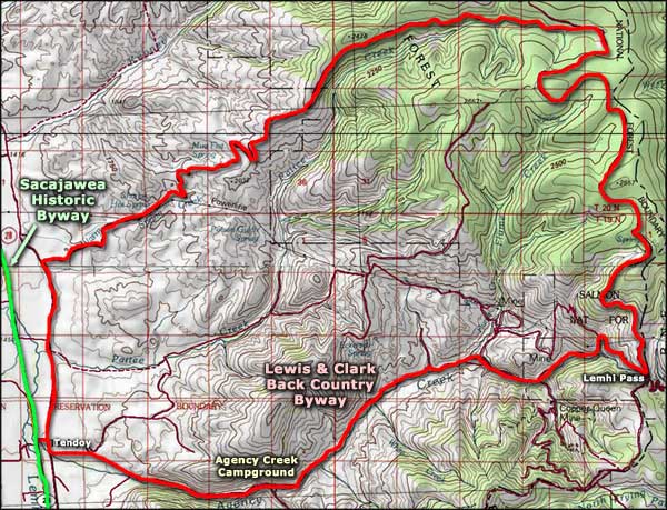 Lewis & Clark Back Country Byway area map |
|
|
 |
| Index - Arizona - Colorado - Idaho - Montana - Nevada - New Mexico - Utah - Wyoming National Forests - National Parks - Scenic Byways - Ski & Snowboard Areas - BLM Sites Wilderness Areas - National Wildlife Refuges - National Trails - Rural Life Advertise With Us - About This Site - Privacy Policy |
| Some photos courtesy of the Idaho Transportation Department. Area map courtesy of National Geographic Topo! Smaller photos courtesy of the Bureau of Land Management. Bottom photo courtesy of the Idaho Department of Tourism. Text Copyright © by Sangres.com. All rights reserved. |