Yellowstone National Park
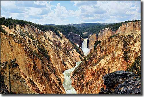
Lower Yellowstone Falls and the Grand Canyon of the Yellowstone
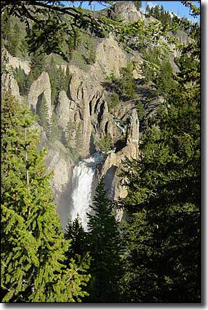
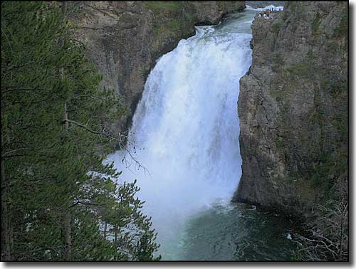
Tower Falls
Yellowstone National Park was the first designated National Park on Earth, created by Congress on March 1, 1872. While the area of Yellowstone was intentionally bypassed by the Lewis & Clark Expedition (after having been told of its existence by members of the Shoshone, Crow and Nez Perce tribes), John Colter of that expedition returned to the area in 1807 and was the first man of European descent to explore the region of Yellowstone. When Colter returned to the cities of the East Coast with his stories of fire and brimstone, erupting geysers, mud pots that would boil eggs in minutes, mountains of glass and such, no one believed him. Over the next 40 years, the reports of various mountain men and trappers who entered Yellowstone were also not believed by folks who hadn't been there to see for themselves. Jim Bridger traveled through Yellowstone in 1856, and as a renowned spinner of tall tales, he also was not believed. However, Bridger's stories did attract the interest of famed geologist and explorer Ferdinand Vandeveer Hayden who embarked on a 2-year survey of the upper Missouri River area in 1859. Hayden started out in the Black Hills area of South Dakota and then headed cross-country for Yellowstone, only to be turned back by heavy snows. Then the American Civil War stopped all organized exploration in the region.
The Cook-Folsom-Peterson Expedition in 1869 was the first that was organized specifically to go into the "Great Geyser Basin." This was 3 explorers with private funding who followed the Yellowstone River to its source at Yellowstone Lake. The information they recorded in their journal was enough to get several Montana residents to organize the Washburn-Langford-Doane Expedition of 1870. (Henry Washburn was the Surveyor-General of Montana, Lt. Gustavus Doane commanded the accompanying U.S. Army detachment, and Nathaniel P. Langford later became famous as "National Park Langford.") They spent a month in the area, naming sites of interest, collecting specimens and just generally exploring. Cornelius Hedges, a member of that expedition, was also a lawyer and writer. Between 1870 and 1871, Hedges wrote a number of articles for the Helena Herald containing details of the expedition's observations. He wasn't the first to suggest that the area be made a National Park and protected and preserved forever. That distinction has been saved for acting Montana Territorial Governor Thomas Francis Meagher who said the area should be protected back in 1865. By 1871, momentum was building in Congress to set aside and preserve the 3,468 square miles that we now know as Yellowstone National Park. The final straw was a government-sponsored expedition led by Ferdinand Hayden (the Hayden Geological Survey of 1871) during which Hayden compiled a comprehensive report on the region that included paintings by Thomas Moran and large-format photographs made by William Henry Jackson.
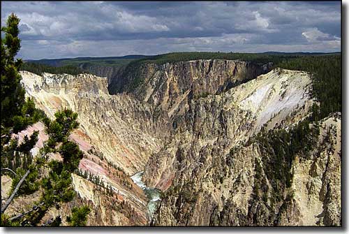
Grand Canyon of the Yellowstone between the Upper and Lower Falls
In 1872, Nathaniel Langford was appointed as the park's first superintendent, however, he was denied a salary and had no funding or staff. Consequently, with no formal regulations or policy or other governmental support, he was unable to properly protect the park or improve the land. In 1875, Colonel William Ludlow was sent by Washington to see what was happening. He and other members of his expedition observed and documented the poaching of elk, deer, antelope and bison for hides. As a result of Ludlow's report to Congress, Langford was forced to step down. Still, neither his successor, Philetus Norris, nor the 3 superintendents who followed Norris were given the manpower or the resources necessary to protect and preserve the land and the wildlife on it.
Until the U.S. Army arrived and built Camp Sheridan (later renamed Fort Yellowstone) in 1886, the poaching and destruction of natural resources continued unabated. In 1888, General Philip Sheridan built the trail that has now become the Beartooth Highway in order to get supplies into Fort Yellowstone. With proper funding and manpower, the army was able to bring the situation under control. The army had to develop their own regulations and policies to protect wildlife and natural resources while still allowing public access. When the National Park Service was finally created by Congress in 1916, many of the army's management principles were adopted by the new service. The National Park Service was finally given control over the property in 1918 and the Army regulars left.
This is just the beginning of the story of the history of the European invaders in the Yellowstone region. In the 1950's, an obsidian point of Clovis origin was found during the digging for the foundation of a post office in Gardiner, Montana. That Clovis point dated Native American presence in the area reaching back about 11,000 years. Within the present-day boundaries of Yellowstone National Park is a large obsidian quarry that provided early Native Americans with the cutting tools and weapons that fueled an active obsidian trade that reached as far to the east as the Mississippi Valley.
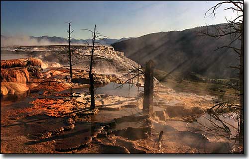
Part of Mammoth Hot Springs
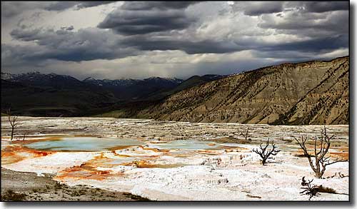
The Upper Terraces at Mammoth Hot Springs
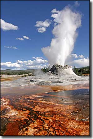
Castle Geyser
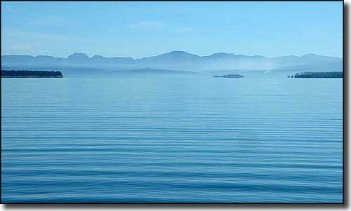
Yellowstone National Park sits atop the caldera of one of the world's largest supervolcanoes and contains probably half the world's geothermal features. The caldera is classed as an active volcano and there's lots of speculation going on about when it will next erupt. The volcano has erupted with tremendous force several times over the last couple million years and most of the land area of Yellowstone is covered with lava flows, rocks and other debris from those eruptions. Yellowstone Lake itself straddles the approximate boundary of the volcanic caldera.
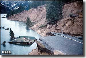
Damage from the 1959 earthquake
The Yellowstone Earthquake of 1959 was centered beneath Hebgen Lake, just west of the western boundary of Yellowstone. The quake was rated at 7.3-7.8 on the Richter scale and caused a huge landslide that killed 28 people and left $11 million (1959 dollars) in damage. That landslide blocked the Madison River and created Quake Lake. In some areas, the land rose as much as 20 feet while in other areas, it dropped as much as 20 feet. Afterwards, several aftershocks were reported ranging from 5.8 to 6.3 in severity. Many roads and structures in the park were damaged while new geysers were found and some older geysers and hot springs lost some of their steam in that northwestern section of Yellowstone.
Chief Joseph Scenic Highway - Buffalo Bill Cody Scenic Byway - Washakie Wilderness
Winegar Hole Wilderness - Jedediah Smith Wilderness - Teton Wilderness
North Absaroka Wilderness - Absaroka-Beartooth Wilderness - Lee Metcalf Wilderness
Bridger-Teton National Forest - Caribou-Targhee National Forest
Shoshone National Forest - Custer National Forest - Gallatin National Forest

