 |
Mount Rose Wilderness |
|
|
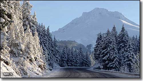 Mount Rose Highway close to the Mount Rose Wilderness |
|
Mount Rose Wilderness includes most of the high country in the Carson Range between Lake Tahoe and Reno, Nevada. Mount Rose Wilderness is split into 2 sections by the Hunter Lake jeep trail. The 5,000+ acres in the northern section see very few visitors. In the 23,000 acres of the southern section is Mount Rose (10,776') and most of the major ridges and canyons of the Carson Range. On the east side of the Wilderness is the Mount Rose Ski Area, on the north side is Reno. While this is probably the most heavily traveled wilderness in Nevada, there are still sections in the center that are almost never visited. Mount Rose Wilderness is in the ecological transition zone between the Sierra Nevada Mountains to the west and the Great Basin to the east. Elevations range from 6,400' to 10,776'. With high ridges and several peaks over 10,000', you can often find views as far as Mt. Shasta, some 200 miles away. There are about 25 miles of designated trails here, leading through everything from open meadows to stands of conifers and aspen to barren high ridges and bald peaks. Among the wildlife you'll find black bear, mule deer, mountain lion and many species of raptors. Easiest access to Mount Rose Wilderness is from trailheads and forest access roads located along the Mount Rose Highway (SR 431). |
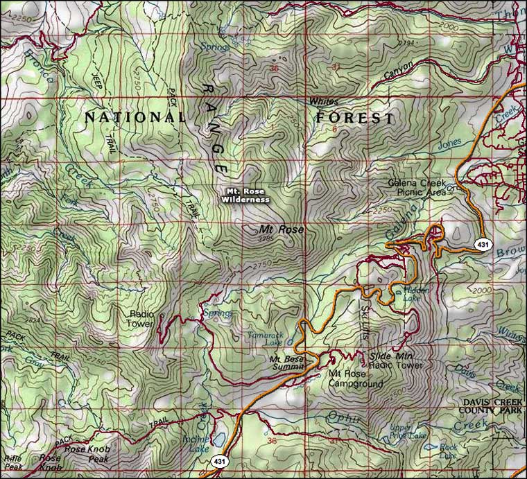 Mount Rose Wilderness map |
|
|

|
| Index - Arizona - Colorado - Idaho - Montana - Nevada - New Mexico - Utah - Wyoming National Forests - National Parks - Scenic Byways - Ski & Snowboard Areas - BLM Sites Wilderness Areas - National Wildlife Refuges - National Trails - Rural Life Advertise With Us - About This Site - Privacy Policy |
| Photo courtesy of Ron Nichols, USDA NRCS. Map courtesy of National Geographic Topo! Text Copyright © by Sangres.com. All rights reserved. |