 |
Buckhorn Back Country Byway |
|
The Buckhorn Back Country Byway crosses the California-Nevada State Line between Ravendale and Nevada Highway 447 (northwestern Nevada, west of the Black Rock Desert-High Rock Canyon Emigrant Trails National Conservation Area). This is a 31-mile route that will probably take you at least 2 hours to drive, unless you start to stop often and enjoy the sights. For parts of the road you'll wish your sturdy steed were a high clearance 4WD vehicle. Pack everything you need and then some: once you leave the pavement there's nothing out there but big views, wild animals, ghost towns and a good time. The route travels through the Twin Peaks Wild Horse and Burro Management Area after crossing the Cottonwood Mountains and before heading for Nevada 447 just below the Duck Lake dry lake bed. You'll also come across the incongruous situation of a beautiful stand of Ponderosa pines growing out of hot sands in the Pine Dunes Research Natural Area, just off the byway. |
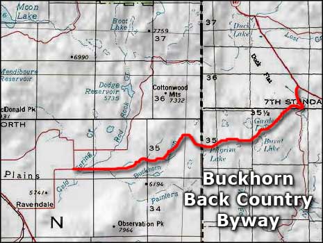 Buckhorn Back Country Byway area map |
|
|

|
| Index - Arizona - Colorado - Idaho - Montana - Nevada - New Mexico - Utah - Wyoming National Forests - National Parks - Scenic Byways - Ski & Snowboard Areas - BLM Sites Wilderness Areas - National Wildlife Refuges - National Trails - Rural Life Advertise With Us - About This Site - Privacy Policy |
| Map courtesy of National Geographic Topo! Text Copyright © by Sangres.com. All rights reserved. |