 |
Carson City, Nevada |
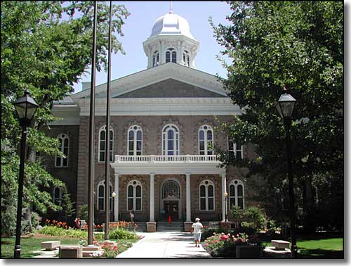 Nevada State Capitol in Carson City |
|
In January, 1843, John C. Fremont and his expedition to California passed through the Eagle Valley, naming the Carson River (after Kit Carson, guide of the expedition) along the way. By 1851, there was a trading post and stopover point built in Eagle Valley along the Carson Branch of the California Trail. In 1858, Abraham Curry bought the trading post and renamed it Carson City. Curry and several partners had the valley surveyed and platted, leaving a 10-acre plot in the center of the townsite for a potential future capitol building. In 1859, the Comstock Lode was discovered and the population began to climb. Curry built the Warm Springs Hotel about a mile east of that 10-acre plot. With the population climbing quickly and Nevada Territory moving toward statehood, Carson City was chosen as the territorial capital. Curry, of course, loaned the Warm Springs Hotel to the territorial government to be used as a meeting hall. Shortly after that the legislature selected the hotel as the Nevada Territorial Prison, and named Curry as its first warden. In 1864, Nevada became a state with Carson City as its permanent capital. At that point, the city began to develop as a commercial center and not just as a mining supply center. The Virginia & Truckee Railroad was built to connect Carson City with what was then the largest settlement in Nevada, Virginia City. A wooden flume was built to carry water from the Sierra Nevada's into Carson City. 1870-1871 saw the construction of the Nevada State Capitol building. Then the city's population and importance dropped when the Southern Pacific built a rail line through Donner Pass. That was too far to the north for Carson City. The city did pick up a bit with new mineral strikes in Goldfield and Tonopah but it took until 1960 to get back up to the city's population in 1880. Since the early days of Nevada, Carson City had been the county seat of Ormsby County but over time, Ormsby Couny was broken up in the formation of other counties. In 1969, Ormsby County was dissolved and Carson City was expanded to its present city limits (encompassing about 146 square miles) as "The Consolidated Municipality of Carson City." |
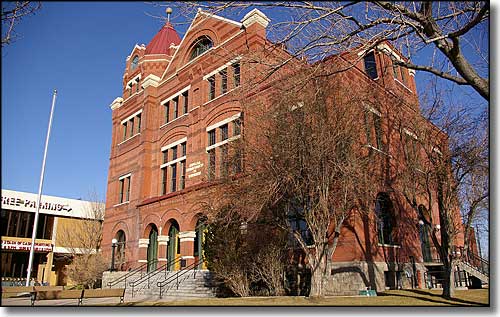 The Laxalt Building, formerly the Carson City Post Office, now a state office building |
| Fast Facts about Carson City, Nevada |
|
Carson City, Nevada
Zip Codes: 89701-89703, 89705, 89706, 89710-89714, 89721 Founded: 1858; Incorporated: 1875 Elevation: 4,802' Latitude: 39.1609°N Longitude: 119.7539°W Resident Racial Breakdown: White Non-Hispanic: 78.5% Hispanic: 14.2% African-American: 1.8% Native American: 3.3% Other: 6.5% Two or More Races: 2.1% Education: High School or Higher: 82.5% Bachelor's Degree or Higher: 18.5% Graduate or Professional Degree: 6.6% 2009 Estimates: Population: 55,176 Males: 28,506 Females: 26,670 Median Resident Age: 38.7 Years Estimated Median Household Income: $50,641 Estimated Median Home Value: $272,856 Population Density: 385 People per Square Mile 2009 Cost of Living Index for Carson City: 92.8 Major Industries: Government, Construction, Health Care, Lodging & Food Services, Entertainment & Recreation, Educational Services, Professional Services, Finance & Insurance Services, Metal & Metal Products, Waste Management Services Unemployed: 4.6% |
|
|
 |
| Index - Arizona - Colorado - Idaho - Montana - Nevada - New Mexico - Utah - Wyoming National Forests - National Parks - Scenic Byways - Ski & Snowboard Areas - BLM Sites Wilderness Areas - National Wildlife Refuges - National Trails - Rural Life Advertise With Us - About This Site - Privacy Policy |
| Photo of the Nevada State Capitol courtesy of Flickr userid OK-59, CCA 3.0 License Photo of the Paul Laxalt Building courtesy of Davemeistermoab, CCA ShareAlike 3.0 License. Text Copyright © by Sangres.com. All rights reserved. |