 |
Muddy Mountains Wilderness |
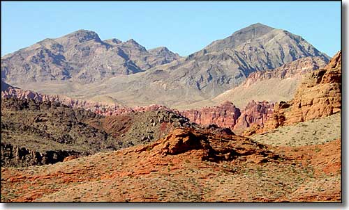 Looking across the Bowl of Fire at the Muddy Mountains Wilderness |
|
The Muddy Mountains Wilderness is some 48,019 acres administered jointly by the Bureau of Land Management and the National Park Service (Lake Mead National Recreation Area). The property is about 20 miles northeast of Las Vegas, near the Valley of Fire State Park. Elevations range from 1,700' to 5,400'. The mountains are the result of an upthrust fault that pushed limestone up and over sandstone layers. In the lower elevations you'll find eroded "windows" through the limestone that expose the underlying layers of gypsum and sandstone (Hidden Valley and Bowl of Fire, both with spectacular outcrops of orange, magenta, red and yellow sandstones with red and brown gypsums). There are also some light brown cliffs (some up to 600' high above the West End Wash) of conglomerate rock in the Gale Hills area and a great example of block faulting at Bitter Ridge. About 300 million years ago, this area was sea bottom, getting buried under the layers of sediment that rained down through the water over the millenia. That's what created the limestone layers. Over the years since that sea receded, the erosive action of wind and water has created the limestone peaks and cut down through the limestone in places to expose multi-colored layers of fossilized sand dunes. Vegetation in the Muddy Mountains Wilderness is typical Mojave Desert: creosote bush, cactus, yucca, Joshua tree and desert willow with a few desert catalpa in the washes. For wildlife you'll find desert bighorn sheep in the higher areas and desert tortoise, desert banded gecko, Great Basin collared lizard, Western chuckwalla and Great Basin whiptail down below. There are also wild horses and burros in the area. There are about 7 miles of maintained trails in the Muddy Mountains Wilderness, mostly leading into the Gale Hills, Hidden Valley and Anniversary Narrows (a small slot canyon in the limestone) areas. In hiking around in the Muddy Mountains Wilderness you may come across any of the many archaeological resources that make this area eligible for listing on the National Register of Historic Places. You can access the Muddy Mountains Wilderness via several state and county roads. North Shore Drive in the Lake Mead National Recreation Area passes between the Muddy Mountains Wilderness and the Pinto Valley Wilderness. The BLM's Bitter Springs Back County Byway also passes near the Muddy Mountains Wilderness on its way into the Buffington Pockets area. The Buffington Pockets, Black Mountains and Bowl of Fire are now proposed wilderness areas. |
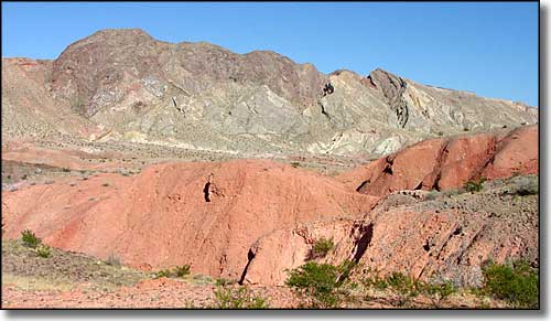 Looking at the Gale Hills in the Muddy Mountains Wilderness 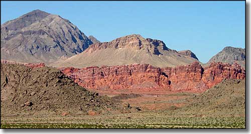 Another shot of the Muddy Mountains across the Bowl of Fire 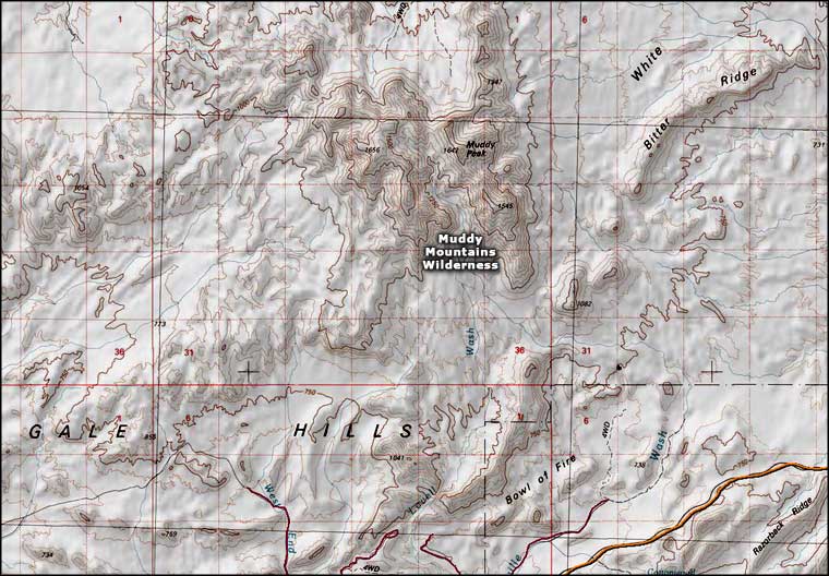 Muddy Mountains Wilderness topo map |
|
|

|
| Index - Arizona - Colorado - Idaho - Montana - Nevada - New Mexico - Utah - Wyoming National Forests - National Parks - Scenic Byways - Ski & Snowboard Areas - BLM Sites Wilderness Areas - National Wildlife Refuges - National Trails - Rural Life Advertise With Us - About This Site - Privacy Policy |
| Photos of the Muddy Mountains Wilderness area are courtesy of the National Park Service. Map courtesy of National Geographic Topo! Text Copyright © by Sangres.com. All rights reserved. |