 |
Black Rock Desert Wilderness |
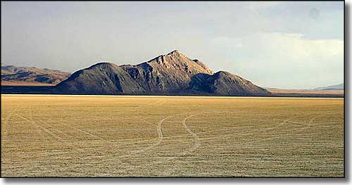 Old Razorback Mountain, Black Rock Desert |
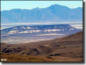
The Black Rock Desert is a dry lake bed left over from the last ice age. This is the bottom of ancient Lake Lahontan, which was at its peak about 12,700 years ago and had this land about 500' below the surface of the lake. Today, this is a huge flat expanse of dry lake, or playa. In the mid-1800's, branches of the Oregon and California Trails made their ways across this enormous barren expanse. Since then there has been scattered mining activity in the area but these days, most of the area is owned by the federal government and administered by the BLM. Large sections of the area have been designated as wilderness by various acts of Congress. The Black Rock Desert Wilderness is about 314,829 acres in the eastern arm of the Black Rock Desert between the South Jackson Mountains Wilderness to the east and the Pahute Peak Wilderness to the west. While most of the area is barren, there are areas of scattered saltbush and greasewood. The playa is at about 3,900' and the highest point is the summit of Elephant Mountain at 5,931' on the western edge of the Wilderness. The remains of several mammoths and parts of several sabre-toothed tigers have been excavated along the pre-historic lakeshore but today, mostly what you'll find for wildlife is mule deer, coyote, pronghorn antelope, mountain lion and sage grouse. This is an area so large, so remote, so barren, that if you have a problem out here and you aren't properly prepared, it just may be fatal. In high snow/water years, about 90 miles of the ephemeral Quinn River that flows through here can be rafted and/or kayaked, just be prepared to hand-carry your boat out after the waters sink into the desert floor. At times, you can even find beaver and muskrat along the banks of the Quinn. Black Rock Desert Wilderness is located in the western part of Humboldt County. To get there, most folks take Jungo Road west out of Winnemucca for 53 miles to the townsite of Sulphur. From Sulphur, they head north on the Sulphur-Jackson Road which forms the eastern boundary of the wilderness. You can also reach the property by following Nevada Highway 140 to the Leonard Creek Road, then head south on that. The Black Rock Desert Wilderness is part of the Black Rock Desert-High Rock Canyon Emigrant Trails National Conservation Area. BLM Map of the Area - 300 KB. |
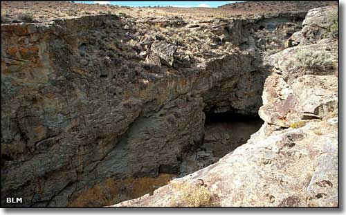 A crack in the Earth, Black Rock Desert Wilderness 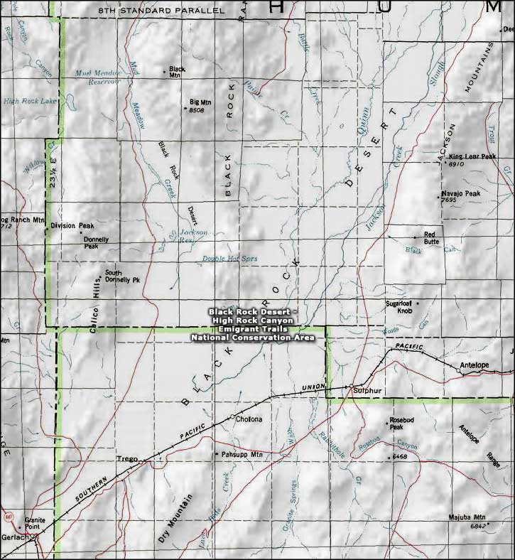 Black Rock Desert Wilderness map |
|
|

|
| Index - Arizona - Colorado - Idaho - Montana - Nevada - New Mexico - Utah - Wyoming National Forests - National Parks - Scenic Byways - Ski & Snowboard Areas - BLM Sites Wilderness Areas - National Wildlife Refuges - National Trails - Rural Life Advertise With Us - About This Site - Privacy Policy |
| Photo of Old Razorback Mountain courtesy of Ikluft, CCA ShareAlike 3.0 License. Lower photo of the Black Rock Desert Wilderness courtesy of the Bureau of Land Management Map courtesy of National Geographic Topo! Text Copyright © by Sangres.com. All rights reserved. |