 |
Becky Peak Wilderness |
 Becky Peak Wilderness |
|
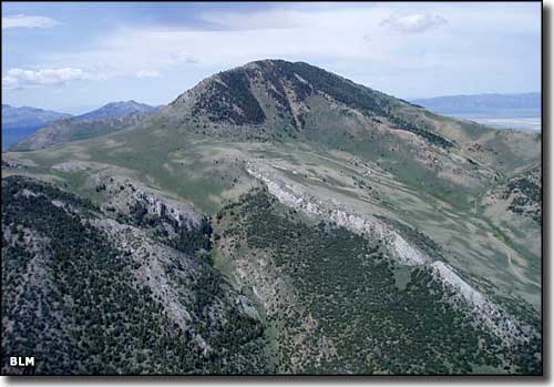
Becky Peak is a 10,023' peak at the northern end of the Schell Creek Range in northern White Pine County. Just across Steptoe Valley from Goshute Canyon, the Becky Peak Wilderness is comprised of 18,119 acres around Becky Peak. This is an area of typical desert grasses and brush that rise into scattered stands of junipers and pinon pines on the upland slopes around Becky Peak. You'll find mule deer, mountain lion, bobcat and maybe mountain goats and bighorn sheep, but hardly any people out here. The nearest town with any services is McGill, about 40 miles to the south. Bring plenty of water: this is mostly barren and bone-dry high desert. Access to Becky Peak Wilderness is reasonably easy: just head east on dirt roads off US 93 about 6 miles south of the fork in the road at Lages Station. |
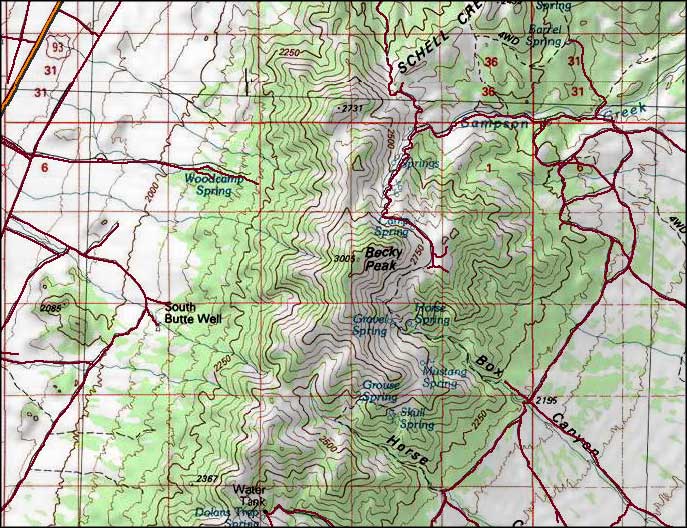 Becky Peak Wilderness map |
|
|

|
| Index - Arizona - Colorado - Idaho - Montana - Nevada - New Mexico - Utah - Wyoming National Forests - National Parks - Scenic Byways - Ski & Snowboard Areas - BLM Sites Wilderness Areas - National Wildlife Refuges - National Trails - Rural Life Advertise With Us - About This Site - Privacy Policy |
| Photos courtesy of the Bureau of Land Management. Map courtesy of National Geographic Topo! Text Copyright © by Sangres.com. All rights reserved. |