 |
Laurel, Montana |
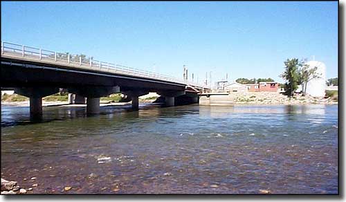 The Yellowstone River at Laurel |
|
Laurel is a railroad town, criss-crossed by several rail lines and by Interstate 94. The "Laurel Yard" is the largest rail yard between Pasco, Washington and St. Paul, Minnesota. Laurel is also home to a Cenex oil refinery. Downtown Laurel has a historic shopping district while most of the area surrounding Laurel is agricultural. |
| Fast Facts about Laurel, Montana |
|
Laurel, Yellowstone County, MT 59044
Elevation: 3,301' Latitude: 45.674°N Longitude: 108.7709°W Resident Racial Breakdown: White Non-Hispanic: 92.6% Hispanic: 4.7% Native American: 1.4% Asian: 0.7% Two or More Races: 0.4% African-American: 0.2% Education: High School or Higher: 85.2% Bachelor's Degree or Higher: 14.9% Graduate or Professional Degree: 3.7%
2009 Estimates: Population: 6,750 Males: 3,223 Females: 3,527 Median Resident Age: 38.4 Years Estimated Median Household Income: $42,400 Estimated Median Home Value: $149,100 Population Density: 3,581 People per Square Mile 2011 Cost of Living Index for Laurel: 88.7 Major Industries: Lodging & Food Services, Health Care, Rail Transportation, Energy Products, Educational Services, Retail Services, Finance & Insurance Services, Government Unemployed (March 2011): 5.9% |
|
|
Yellowstone County Related Pages
Ballantine - Billings - Broadview - Custer - Huntley
Lockwood - Shepherd - Worden - Yellowstone County Other Yellowstone County Related Pages
Acton Recreation Area - BLM - Pompeys Pillar National Monument
Nez Perce National Historic Park: Canyon Creek Battlefield Sundance Lodge - BLM - Four Dances Natural Area - BLM Shepherd Ah Nei Recreation Area - BLM Montana Pages |
 |
| Index - Arizona - Colorado - Idaho - Montana - Nevada - New Mexico - Utah - Wyoming National Forests - National Parks - Scenic Byways - Ski & Snowboard Areas - BLM Sites Wilderness Areas - National Wildlife Refuges - National Trails - Rural Life Advertise With Us - About This Site - Privacy Policy |
|
Text Copyright © by Sangres.com. All rights reserved. |