 |
Beaverhead-Deerlodge National Forest TrailsHiking, Biking, Horseback Riding, Snowmobiling
|
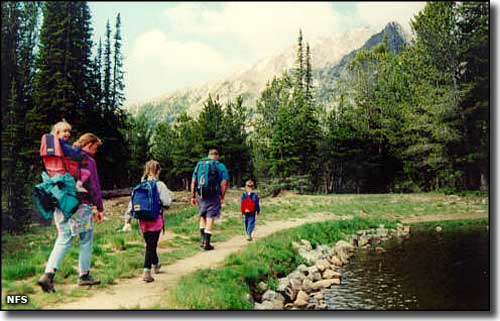 |
There are more than 1,500 miles of trails on the Beaverhead-Deerlodge National Forest. Hiking, biking and horseback riding trails turn into cross-country skiing and snowmobiling trails (except in the Anaconda-Pintler and Lee Metcalf Wilderness Areas where motorized/mechanized vehicles are not allowed). Among the busiest hiking trails:
|
| Snowmobile Trail Information |
Trail Name and Location |
Miles of Trail |
Information Available From: |
Remarks and Restrictions |
|---|---|---|---|
| Wyman/Odell/Lacy Creek - 17 miles south of Wise River | 13 miles marked/groomed | Wise River Ranger District | Cooperative venture with Montana Fish, Wildlife, and Parks and Wise River Jackpine Savages Snowmobile Club. Map available at district office. |
| Wise River/Elkhorn Hot Springs - 7 miles south of Wise River or 40 miles northwest of Dillon | 23 miles marked/groomed | Wise River or Dillon Ranger Districts | Cooperative venture with Montana Fish, Wildlife, and Parks, Beaverhead Sno-Riders Club of Dillon, and Wise River Jackpine Savages Snowmobile Club. National Recreation Trail. Map available at district office. |
| Comet Ridge - 2 miles northeast of Elkhorn Hot Springs | 4 miles marked/groomed | Wise River or Dillon Ranger Districts | Cooperative venture with Montana Fish, Wildlife, and Parks, Beaverhead Sno-Riders Club of Dillon, and Wise River Jackpine Savages Snowmobile Club. National Recreation Trail. Map available at district office. |
| Price Creek/Mona Creek - 4 miles northeast of Elkhorn Hot Springs | 5 miles marked/groomed | Wise River or Dillon Ranger Districts | Cooperative venture with Montana Fish, Wildlife, and Parks, Beaverhead Sno-Riders Club of Dillon, and Wise River Jackpine Savages Snowmobile Club. National Recreation Trail. Map available at district office. |
| Elk Park - 8 miles north of Butte on I-15 to Elk Park exit. Then 2 miles west on Lowland Road 442. | 38 miles marked/groomed | Butte Ranger District | Cooperative venture between Montana Fish, Wildlife, and Parks and the Mining City Trail Riders. Map available at district office. |
| Black Butte/Lobo Mesa Loop - junction of Highway 287 and West Fork Road 209 (33 miles south of Ennis) | 25 miles marked/groomed; 25 miles marked | Madison Ranger District | Trail starts at Lyon Bridge, 33 miles south of Ennis on Highway 287. Black Butte Cabin at end of trail is available for rent. Snowmobile trail uses existing roads and trails to form this 50-mile loop through the Gravelly Range. |
| Antelope Basin - State Highway 87 to Raynolds Pass and into Idaho, west on Red Rock Lake Road to Rock Pass and on to the Elk Lake Resort. | 20 miles marked | Madison Ranger District | Several access points, including Island Park via Red Rock Pass, Raynolds Pass, and Antelope Basin. Elk Lake Camp Resort serves meals and is open in winter. |
| Twin Lakes - 8 miles north of Ennis on Highway 287 to McAllister and 10 miles west on North Meadow Creek Road to Forest boundary | 11 miles marked/groomed; 14 miles marked | Madison Ranger District | Groomed under agreement with Montana Fish, Wildlife, and Parks and Virginia City Snowmobile Club. Lots of loop options, lakes and historic mine structures. |
| Virginia City/Clover Meadows - Virginia City | 25 miles marked/groomed | Madison Ranger District | Virginia City Chamber of Commerce grooms under cooperative agreement with Montana Fish, Wildlife, and Parks, Bureau of Land Management, and Forest Service. Starts in Virginia City. |
| Big Hole/Bitterroot Road - Trail Creek off South Highway 43 | 8 miles marked/intermittently groomed | Wisdom Ranger District | Cooperative venture between Montana Fish, Wildlife, and Parks and the Big Hole Snowmobile Club. Must stay off cross-country ski trails marked with blue diamonds. |
| Twin Lakes/Ajax Lakes System - 20 miles south of Wisdom | 7 miles marked/groomed; 14 miles marked | Wisdom Ranger District | Cooperative venture with Big Hole Snowmobile Club. Map available at district office or Big Hole Battlefield; outhouses available at Twin Lakes. Parking along the Twin Lakes Road below the Forest boundary. |
| Miner Lake Trail - 7 miles south of Jackson | 3.5 miles marked | Wisdom Ranger District | Map available at district office or Big Hole Battlefield; outhouses at Miner Lake. |
| Bloody Dick Trail - 11 miles south of Jackson | 13 miles marked | Wisdom Ranger District | Map available at district office or Big Hole Battlefield; outhouses at Reservoir Lake and South Van Houten Lake. |
| Schultz-Johnson Trail - 15 miles west of Wisdom or 12 miles east of Lost Trail Pass on Highway 43 | 17 miles marked/groomed | Wisdom Ranger District | Map available at district office or Big Hole Battlefield; trail continues over pass onto Sula Ranger District of the Bitterroot National Forest, but is not marked or groomed. |
| Stewart Meadows Complex - .5 miles north of Wisdom | 39 miles marked/groomed | Wisdom Ranger District | Cooperative venture with Big Hole Snowmobile Club and Montana Fish, Wildlife, and Parks. Map available at district office or Big Hole Battlefield; connects with Wise River/Polaris snowmobile trail. |
| Gibbonsville Trail - 14 miles west of Wisdom | 9 miles marked/groomed; 5 miles marked/groomed BLM and State | Wisdom Ranger District | Map available at district office; continues over Big Hole Pass (Continental Divide) into Idaho, but is not marked or groomed. |
| Red Lion - Georgetown Lake | 32 miles marked/groomed | Pintler Ranger District | Cooperative venture with Montana Fish, Wildlife, and Parks and the Anaconda Snowmobile Club. Parking available at Cable Mountain Campground and Red Bridge Boat Launch. Map available at district office. |
| Georgetown Lake/East Fork/Storm Lake | 52 miles marked/groomed; another 4 miles marked | Pintler Ranger District | Cooperative venture with Montana Fish, Wildlife, and Parks and the Anaconda Snowmobile Club. Parking available at various locations around Georgetown Lake. Maps available at district office. |
| Continental Divide/Leadville - 6 miles southeast of Deer Lodge | 57 miles marked/groomed; another 31 miles marked | Pintler Ranger District | Cooperative venture with Deer Lodge Snowmobile Club and Montana Fish, Wildlife, and Parks. Map available at district office. Parking available on Peterson Creek Road, east of Deer Lodge. |
| Rimini/Elliston/Basin Trail System - .7 miles east of Basin | 161 miles marked/groomed | Jefferson Ranger District or Helena Ranger District | Cooperative venture with Helena Snowdrifters Snowmobile Club and Montana Fish, Wildlife, and Parks. This trail system spans an area on Helena and Deerlodge National Forests. Selected trails are groomed as funding is available. Roadside parking at Cataract Creek. Other access available from Helena National Forest. Maps available at district offices. |
| Cross Country Ski Trails |
| Trail Name and Location | Kilometers of Trail | Information Available From: | Remarks and Restrictions |
|---|---|---|---|
| Elkhorn Hot Springs Ski Trails - 37 miles northwest of Dillon | 23.3 km MOST DIFFICULT No grooming |
Dillon Ranger District | Trail begins at plowed parking lot near Elkhorn Hot Springs Resort. Trail system consists of several loops with approximately 1,000 feet of climb. Trail map available. |
| Birch Creek - 21 miles northwest of Dillon | 5.0 km MORE DIFFICULT No grooming |
Dillon Ranger District | Trail begins across Birch Creek bridge on the Birch Creek road about 1 mile west of the junction with the Willow Creek road. Trail map available. |
| Cabinet Creek - 26 miles west of Wisdom | 9.6 km MORE DIFFICULT No grooming |
Wisdom Ranger District | Trail begins at plowed parking area on Highway 43 and follows Cabinet Creek to junction with Anderson Mountain Road; has some steep pitches. Can use either Anderson Mountain Road or Richardson Ridge Trail to make semi-loops. Trail map available. |
| Chief Joseph Cross-Country Trails - 28 miles west of Wisdom | 8 km EASIEST 14.5 km MORE DIFFICULT 2.1 km MOST DIFFICULT Weekly grooming |
Wisdom Ranger District | Trail system starts on north side of Highway 43 at Chief Joseph Pass. Plowed parking for 55-60 vehicles; toilet and maps available at trailhead. Trail system consists of several loops which provide a variety of lengths and skill levels. Trails groomed by the Bitterroot Ski Club. No pets, please. Warming hut open 12/1 to 04/15. |
| Shoofly - 22 miles west of Wisdom | 7.2 km MORE DIFFICULT No grooming |
Wisdom Ranger District | Parking at plowed lot on Highway 43. Trail starts on north side of highway. Trail map available. |
| Richardson Creek - 26 miles west of Wisdom | 6.1 km MORE DIFFICULT No grooming |
Wisdom Ranger District | Parking at plowed lot on Highway 43; trail starts from lot. Can use Cabinet Creek Trail or Anderson Mountain Road to make semi-loops. Trail map available. |
| Scotter Creek Trail - 26 miles west of Wisdom | 4.8 km MORE DIFFICULT No grooming |
Wisdom Ranger District | Trail connects Chief Joseph Pass groomed trail system with Shoofly Trail. Trail map available. |
| Anderrick Trail - 28 miles west of Wisdom | 3.2 km EASIEST No grooming |
Wisdom Ranger District | Trail connects Anderson Mountain Road and Richardson Creek Trail to form a loop. Trail map available. |
| Anderson Mountain Road - 28 miles west of Wisdom | 12.8 km MORE DIFFICULT No grooming |
Wisdom Ranger District | Trail begins on south side of Chief Joseph Pass. Can use Richardson Creek or Cabinet Creek Trails to make semi-loops. Trail map available. |
| Gibbons Pass Road - off Highway 43 at Chief Joseph Pass, 28 miles west of Wisdom | 3.2 km EASIESTbr/>
4.3 km MORE DIFFICULT No grooming |
Wisdom Ranger District | About 7.5 km of excellent skiing with moderate slope and open areas for telemarking. Open to snowmobiles. Trail map available. |
| May Creek Trail - 16 miles west of Wisdom | 9.6 km MORE DIFFICULT No grooming |
Wisdom Ranger District | Trail begins from May Creek Campground and joins Cabinet Creek Trail at end. Can use Cabinet Creek and May Creek Ridge Trails to form loop. Trail map available. |
| May Creek Ridge Trail - 16 miles west of Wisdom | 13.7 km MOST DIFFICULT No grooming |
Wisdom Ranger District | Trail begins from May Creek Campground; not marked as ski trail but does have standard trail blazes. Can use with Cabinet Creek Trail and May Creek Trail to form loop. Trail map available. |
| Wade Lake Ski Trails - 40 miles south of Ennis on Highway 287 to Wade Lake Access Road and 6 miles to Resort | 35 km EASIEST Groomed |
Madison Ranger District | Several routes of set track provide skiers with touring of Cliff and Wade Lakes and scenic vistas of the area; food and lodging are available at the resort. Trail map available. |
| Lodgepole Ridge Ski Trails - Georgetown Lake | 7.7 km MORE DIFFICULT 1.1 km MOST DIFFICULT No grooming |
Pintler Ranger District | Parking available at Red Bridge Boat Launch. Trail map available at forest offices. |
| Cable Campground Ski Trails - Discovery Basin Ski Area | 5.2 km MORE DIFFICULT No grooming |
Pintler Ranger District | Parking available at Discovery Basin Ski Area. Trail map available at the ski area and forest offices. |
| Discovery Basin Ski Trails - Discovery Basin Ski Area | 5.2 km EASIEST, intermittent grooming. 3.1 km MORE DIFFICULT. 9.6 km MOST DIFFICULT, no grooming. |
Pintler Ranger District | Parking available at Discovery Basin Ski Area. Trail map available at the ski area and forest offices. |
|
|
 |
| Index - Arizona - Colorado - Idaho - Montana - Nevada - New Mexico - Utah - Wyoming National Forests - National Parks - Scenic Byways - Ski & Snowboard Areas - BLM Sites Wilderness Areas - National Wildlife Refuges - National Trails - Rural Life Advertise With Us - About This Site - Privacy Policy |
| Photos courtesy of the National Forest Service. Text Copyright © by Sangres.com. All rights reserved. |