 |
Lucky Peak State Park |
|
Lucky Peak State Park is comprised of 4 units, 3 of which are on or around Lucky Peak Reservoir. Lucky Peak Reservoir is about 12 miles long with about 45 miles of shoreline. Below the dam you'll find Discovery Park, a roadside park popular for picnics, walking the dog and fishing in the Boise River. This is also a flat water area good for canoes and kayaks. At the foot of the dam is Sandy Point (34-acres), a popular spot for clear, cool water on a sandy beach. There's also 2 volleyball courts and a giant fountain here with picnic tables, restrooms, a snack bar and barbeque grills. Then there's the Idaho City Backcountry Yurts and Trail System: a series of hiking, biking and cross-country ski trails with yurts available for rent in the "backcountry." At the upper end of Lucky Peak Reservoir there's the Spring Shores Marina, a 208-acre unit with a full service marina (298 boat slips), long-term moorage, fuel, marina supplies, restaurant, a convenience store, picnic area, swim beach and recreation equipment rentals. The parking lots have plenty of room for trailers and offer 2 boat ramps for water access. Outdoor Adventures Inc. also offers commercial boat and personal watercraft (read: jet ski) rentals at Spring Shores. Northwest Magazine rated Lucky Peak State Park as one of the Northwest's top 25 parks in 1999. |
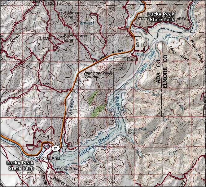 Lucky Peak State Park area map |
|
|
 |
| Index - Arizona - Colorado - Idaho - Montana - Nevada - New Mexico - Utah - Wyoming National Forests - National Parks - Scenic Byways - Ski & Snowboard Areas - BLM Sites Wilderness Areas - National Wildlife Refuges - National Trails - Rural Life Advertise With Us - About This Site - Privacy Policy |
| Map courtesy of National Geographic Topo! Text Copyright © by Sangres.com. All rights reserved. |