 |
Brundage Mountain Resort |
 Brundage Mountain rises above Payette Lake |
|
Brundage Mountain Resort offers excellent snow on the 46 groomed runs, or incredible deep powder on limitless runs off the beaten paths. Brundage also offers snocat skiing on 19,000 acres of backcountry with one- and two-day trips available (with overnights in a wood-fire-heated back country yurt). Brundage Mountain Resort is just 8 miles north of McCall in Payette National Forest. |
|
Quick Facts about Brundage Mountain Resort |
|
Payette National Forest
Nearest City: McCall GPS Coordinates: 45.004, -116.145 Google Satellite Map Season: Late November to early April (Weather permitting) Hours of operation: 9:30 AM to 4:00 PM Lifts: 5 * 4 triple chair * 1 high speed quad Base Elevation: 5,840 ft
Top Elevation: 7,640 ft Vertical Rise: 1,800 ft Skiable Terrain: 1,500 Acres Average Annual Snowfall: 350 inches Number of Trails: 46 Trails Classifications: Beginner: 30% More Difficult: 50% Most Difficult: 20% Longest Run: 1.75 miles |
Click on either of these maps for larger versions: Brundage Mountain front side 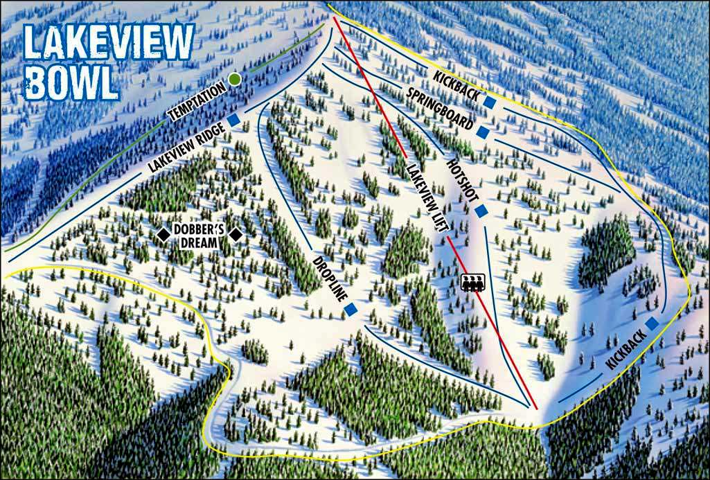 Brundage Mountain, Lakeview Bowl 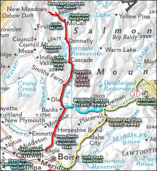 Brundage Mountain Resort area map |
|
|
Brundage Mountain Resort Related Pages
Idaho Ski & Snowboard Areas - Payette River Scenic Byway - Wildlife Canyon Scenic Byway
Ponderosa Pine Scenic Byway - Little Ski Hill - Bogus Basin Mountain Recreation Area Tamarack Ski Resort - Lake Cascade State Park - Ponderosa State Park - Lucky Peak State Park Eagle Island State Park - Deer Flat National Wildlife Refuge - Sawtooth Wilderness Idaho Pages |
 |
| Index - Arizona - Colorado - Idaho - Montana - Nevada - New Mexico - Utah - Wyoming National Forests - National Parks - Scenic Byways - Ski & Snowboard Areas - BLM Sites Wilderness Areas - National Wildlife Refuges - National Trails - Rural Life Advertise With Us - About This Site - Privacy Policy |
|
Upper photo courtesy of mountainsofexperience.com. Ski Trails Maps courtesy of Brundage Mountain Resort Text Copyright © by Sangres.com. All rights reserved. |