 |
Pend Oreille Scenic Byway |
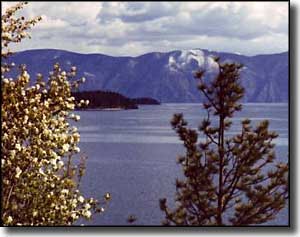
 A view across Lake Pend Oreille, Schweitzer Mountain in the distance |
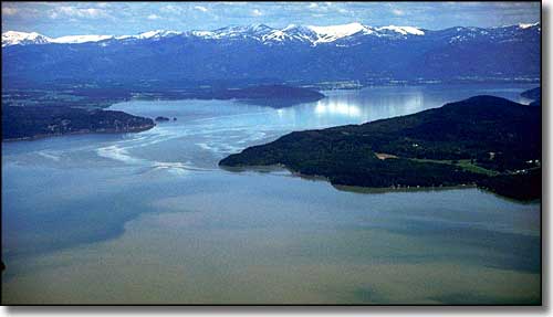
The Pend Oreille Scenic Byway makes the journey eastward from Sandpoint to the Montana State line via Idaho Highway 200. While a lot of the route is along the rocky northern shore of Lake Pend Oreille, you'll also pass across wide open farmlands and through river deltas along the edge of this glacial trench that was created during the last Ice Age and then filled with the floodwaters of Glacial Lake Missoula. This is an area where incredible numbers of migratory waterfowl and other birds share the wetlands resources with numerous moose, otters, beavers, muskrats and other water-loving mammals. The first trading post in Idaho was built in 1809 by trappers working under David Thompson of the Northwest Fur Company. They built that trading post near what is now "Hope." Most of the other towns along the byway were founded beside railroad sidings after the Great Northern Railroad built through the area in the 1880's. For many years, they shipped timber and wood products on the trains passing through. These days, the timber business has dropped way off but tourism and recreational activities have picked up considerably with every kind of accommodation available from primitive campsites to condos to five-star lakeside resorts. The Pend Oreille Scenic Byway is a 33-mile route with numerous turnouts, parking areas and interpretive exhibits along the way to help you enjoy your visit even more. As nearly the entire drive is along the lake shore, there are several boat ramps and beaches available, too. If you can tear your eyes away from the sheer beauty of all that open water and look across the highway, you'll see mountain after mountain rising almost directly from that other ditch beside the road. This is the Kaniksu National Forest, part of the Idaho Panhandle National Forests. This is an area with hundreds of miles of hiking, mountain biking and horseback riding trails. The fishing and hunting are excellent, and the views just never quit. In winter this is a wonderland of snow with hundreds of miles of snowmobile and cross-country ski trails in the area. Or you could just go to Schweitzer Mountain Resort (just north of Sandpoint) and enjoy some incredible big hill downhill skiing. At the corner in Sandpoint where the Pend Oreille Scenic Byway begins, you'll also find the beginnings of the Wildhorse Trail Scenic Byway and the Panhandle Historic Rivers Passage (both parts of the International Selkirk Loop). |
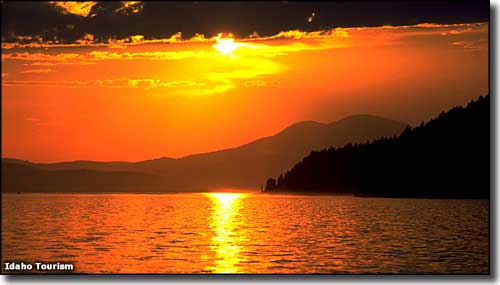 Sunset over Lake Pend Oreille 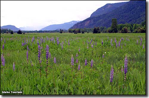 In the valley of Clarks Fork River 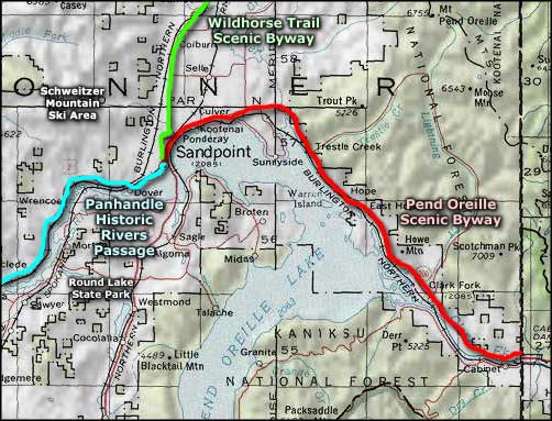 Pend Oreille Scenic Byway area map |
|
|
 |
| Index - Arizona - Colorado - Idaho - Montana - Nevada - New Mexico - Utah - Wyoming National Forests - National Parks - Scenic Byways - Ski & Snowboard Areas - BLM Sites Wilderness Areas - National Wildlife Refuges - National Trails - Rural Life Advertise With Us - About This Site - Privacy Policy |
| Upper photo of Lake Pend Oreille courtesy of the US Army Corps of Engineers. Lower photos courtesy of the Idaho Department of Tourism. Area map courtesy of National Geographic Topo! Text Copyright © by Sangres.com. All rights reserved. |