 |
Dover, Idaho |
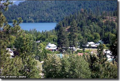 Dover, Idaho and the Pend Oreille River |
|
Dover is essentially a suburb of Sandpoint. The town is located on the Pend Oreille River, just downstream from the lake itself. When Lewis & Clark journeyed through the area in 1806, the Kalispel (a sub-group of the Flathead tribe) were living here. They were given the name "Pend Oreille" because they had a habit of wearing large seashells dangling from their ears. A few years after Lewis & Clark came explorer and fur trapper David Thompson. He traded with the Kalispel on behalf of the Northwest Fur Company, a British trade venture that (together with the Hudsons Bay Company) controlled most trade in the Northwest up into the 1840's. Anglo-American settlement in the area didn't really start until the mid-1870's, then the Northern Pacific Railroad built its main transcontinental line through Sandpoint, Dover and Laclede in 1883. The settlement at Dover began as a crew camp and railroad siding. Once the track construction was complete, nearly all the Chinese railroad laborers were let go and flooded all across the western states looking for work. A few settled in the Dover area. For many years after the turn of the century, the Dover area was home to large timber operations and sawmills. A massive fire in Laclede in 1922 led to the closing of that town and subsequent removal of most of the buildings to Dover. Every few years, the Pend Oreille River would flood and cause problems in the little town. Eventually, the Army Corps of Engineers built the Albeni Falls dam nearby and the river was regulated. 1963 saw the beginning of ski-run development at nearby Schweitzer Mountain. In the late 1980's, Sandpoint was trying to annex Dover but wouldn't promise the citizens anything but higher taxes. So the local folks banded together and filed incorporation papers with the county. The incorporation was allowed and the folks were finally able to get a real water system built. That was about the same time the last timber operations shut down and the mill burned, soon to be torn down completely and removed. US Highway 2 through Dover is the route of the Panhandle Historic Rivers Passage, a designated scenic byway that is also part of the International Selkirk Loop. |
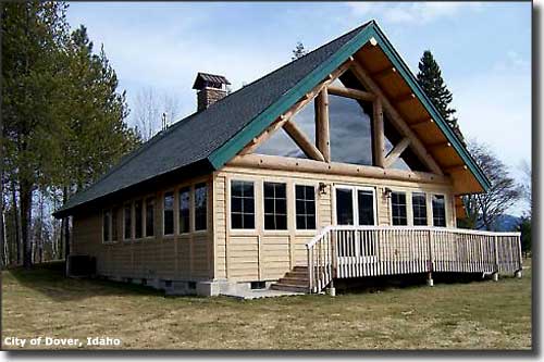 Dover City Hall |
| Fast Facts about Dover, Idaho |
|
Dover, Bonner County, ID 83825
Incorporated: 1988 Elevation: 2,070' Latitude: 48.2536°N Longitude: 116.6003°W Resident Racial Breakdown: White Non-Hispanic: 96.8% Hispanic: 2.8% Native American: 0.5% Education: High School or Higher: 84.3% Bachelor's Degree or Higher: 28.7% Graduate or Professional Degree: 9.0%
2009 Estimates: Population: 380 Males: 202 Females: 178 Median Resident Age: 45.9 Years Estimated Median Household Income: $35,700 Estimated Median Home Value: $301,800 Population Density: 284 People per Square Mile 2011 Cost of Living Index for Dover: 88.8 Major Industries: Health Care, Educational Services, Lodging & Food Services, Construction, Forestry & Timber Products, Automotive Services, Real Estate Services, Waste Management Services, Entertainment & Recreation Unemployed (March 2011): 16.1% |
|
|
Bonner County Pages
Clark Fork - East Hope - Hope - Kootenai - Oldtown
Ponderay - Priest River - Sandpoint - Bonner County Bonner County Related Pages
Farragut State Park - Priest Lake State Park - Round Lake State Park
Pend Oreille Scenic Byway - Panhandle Historic Rivers Passage Wild Horse Trail Scenic Byway - Schweitzer Mountain Ski Resort Idaho Pages |
 |
| Index - Arizona - Colorado - Idaho - Montana - Nevada - New Mexico - Utah - Wyoming National Forests - National Parks - Scenic Byways - Ski & Snowboard Areas - BLM Sites Wilderness Areas - National Wildlife Refuges - National Trails - Rural Life Advertise With Us - About This Site - Privacy Policy |
| Photos of Dover courtesy of the City of Dover. Text Copyright © by Sangres.com. All rights reserved. |