 |
Monarch Pass |
|
|
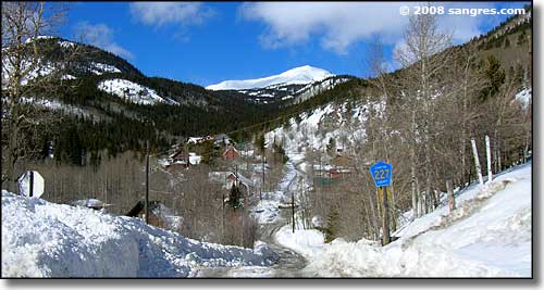 Looking west across Garfield, at the eastern foot of Monarch pass |
|
|
|
Monarch Pass bridges the Continental Divide between the Sawatch Mountains to the north and the Cochetopa Hills to the south. It's long and slow and windy and, of course, I just had to drive it for these photos in early February. We were originally told to prepare for a cold and dry winter, but nearly every major drainage in Colorado has 150% or more average snowpack at the end of February, 2008. It's a long climb up the hill but the scenery is excellent. I wasn't in a hurry and stopped often. I would have stopped more but the snowbanks were too high in many places and there was a shortage of safe turn-outs. The summit area was wide open to the east and south but that western and northern snowbank had to be 20 feet high right there at the top. Most of Monarch Pass is in Chaffee County but you pass into Saguache County west of the summit and then into Gunnison County near the western foot of the pass. |
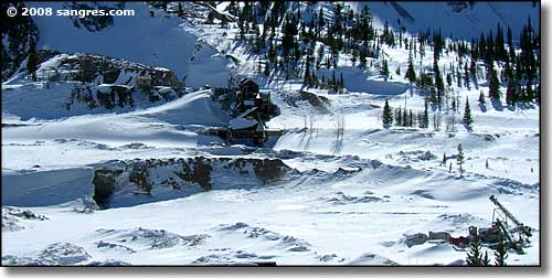 An old mine site on the eastern side of the pass 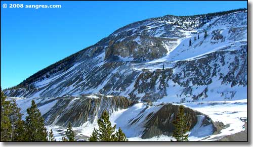 Another part of that old mine site 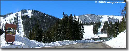 Monarch Mountain Ski Area 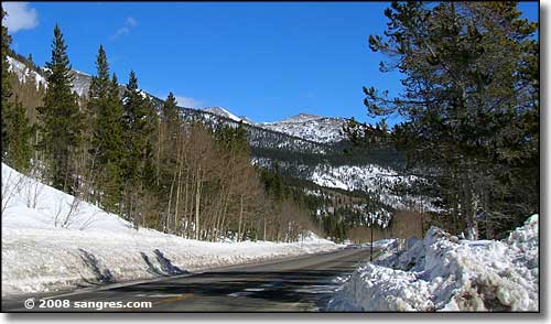 Still on the eastern side of the summit 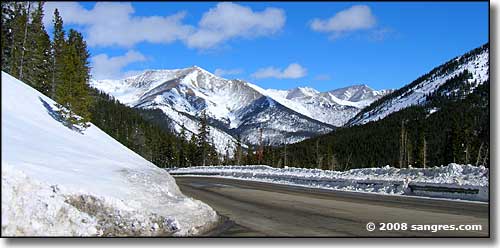 Looking east just below the summit of Monarch Pass 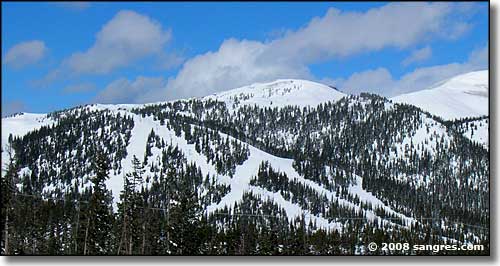 Looking down on Monarch Ski Area from near the summit of Monarch Pass 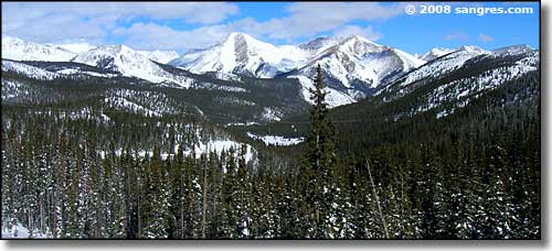 The eastern view from the summit 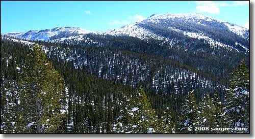 Looking south, just over the summit on the western side 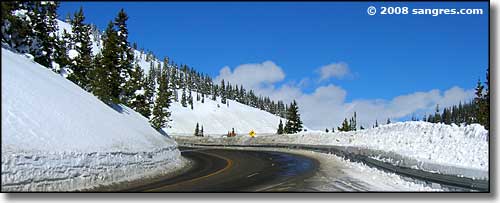 About half-a-mile west of the summit 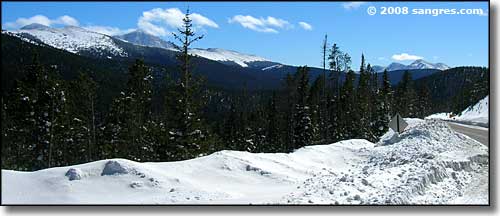 Another look to the south 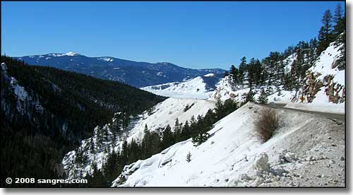 The western foot of the pass is finally in sight 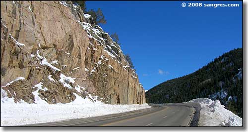 Some of the granite along the way 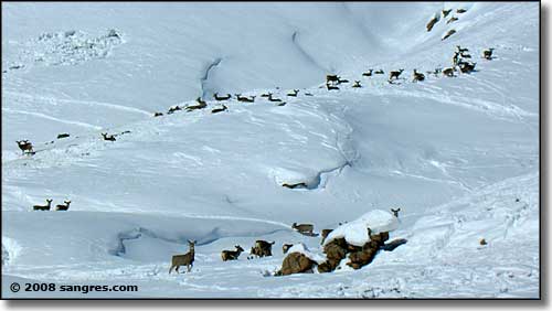 This herd of mule deer was on the northern side of the valley at the western foot of the pass |
| Clicking on the photo below will open a new window or new tab in your browser and bring you a larger version of that photo. To return, just close that window or tab. 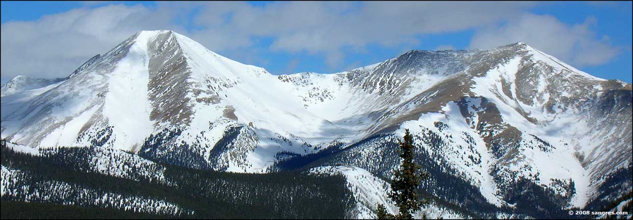 East of the summit |
|
|
Monarch Pass Related Pages
Monarch Ski Area - Sawatch Mountains
Gunnison National Forest - San Isabel National Forest Chaffee County - Saguache County - Gunnison County Colorado Pages
Towns & Places - Scenic Byways - State Parks - BLM Sites - History & Heritage
Ski & Snowboard Areas - Photo Galleries - Colorado Mountains - Scenic Railroads Unique Natural Features - Wilderness Areas - Outdoor Sports & Recreation Colorado's National Forests - National Wildlife Refuges - Colorado's National Parks |
 |
| Index - Arizona - Colorado - Idaho - Montana - Nevada - New Mexico - Utah - Wyoming National Forests - National Parks - Scenic Byways - Ski & Snowboard Areas - BLM Sites Wilderness Areas - National Wildlife Refuges - National Trails - Rural Life Sponsor Sangres.com - About Sangres.com - Privacy Policy - Accessibility |
| Photos courtesy of Sangres.com, CCA ShareAlike 3.0 License. Text Copyright © by Sangres.com. All rights reserved. |