
Scenic Highway of Legends
La Veta to Walsenburg

Looking north at sunset, coming out of La Veta
State Highway 12, the Scenic Highway of Legends travels about 5 miles northeast from downtown La Veta, going quickly uphill near the La Veta-Cuchara Valley Airport, to its' junction with US Highway 160, a primary route between the I-25 at Walsenburg and the San Luis Valley, Pagosa Springs, Durango and Cortez.

The West Spanish Peak at sunset, from near La Veta

Looking at La Veta from the north
The Scenic Byway route goes east to Walsenburg, paralleling the Cuchara River. Along the way there are some great views of the Spanish Peaks to the south. You will also come by a Santuario on the north side of the road.
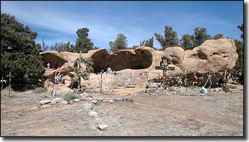
A Santuario along the road
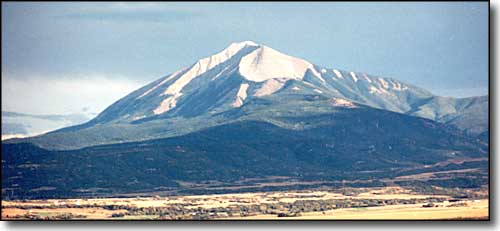
The East Spanish Peak
Four miles west of Walsenburg is the Spanish Peaks Regional Health Center on the south side of the road and Lathrop State Park on the north side of the road.

Spanish Peaks Regional Health Center

Lathrop State Park Visitor Center
Lathrop State Park is Colorado's oldest State Park. Lathrop features two boating and excellent fishing lakes (Horseshoe and Martin) with a swimming beach on Martin Lake. Lots of picnic sites and camping spots in the Park, too. The Visitors Center walls are covered with murals depicting the history of the area from the days of the Mesa Verde Cliff Dwellers to the coal strikes of the early 1900's. From almost anywhere in the Park, the views of the Spanish Peaks are spectacular. On the east side of Lathrop is the Walsenburg Municipal Golf Course (9 holes).

On Horseshoe Lake at Lathrop State Park

The Spanish Peaks
Native American legends say that at the beginning of time, a Paradise existed on Earth at the foot of the Wahatoyas: a Paradise where no one suffered pain or cold or was even unhappy. That blissful state continued until the "invasion from the north." Then, the gods of Huajatolla became angry and made that Paradise no different from the rest of the World. Later, the Rain Gods took possession of the Great Mountains and made clouds and dispatched them all over the World. The Native Americans believed that "Huajatolla are the Breasts of the World, and all living things derive their sustenance from them. Without the clouds there is no rain, and with no rain we have no food and we perish." And so, still today, when the clouds hang low over the Breasts of the World (Wahatoya), they spoon-feed (Cuchara) the orphan land (Huerfano).
Coming into Walsenburg, the speed limit drops at the edge of town. That's fine because there's only a mile to go before turning right on Main Street and heading out onto the I-25 for the journey back to Trinidad. Along the way you'll find restaurants, gas stations, convenience stores and motels in Walsenburg. You'll also pass by the city park, complete with swimming pool. If you turn left at Main Street and head north, that road leads to Exit 52 on the I-25, just after the intersection with State Highway 69, the road to Westcliffe and Custer County.
