
Los Caminos Antiguos Scenic Byway
Fort Garland to the Great Sand Dunes

Blanca Massif, from Blanca, Colorado
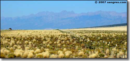
At the intersection with US 160 in Fort Garland, go left. It's 4 miles to Blanca and then another 10 miles to State Road 150. The turn is well-signed, this being one of the main roads to Great Sand Dunes National Park & Preserve. I stopped at the turn-off and took a few photos. While the area around Blanca and Fort Garland is heavily irrigated and produces lots of hay and potatoes, this area around the turn-off is not. This is high altitude desert and you really wouldn't know that beneath you is a huge aquifer. Being so close to lush mountain scenery makes such a contrast. That straight line at the bottom of the photo above (it looks like a fault in the photo) is actually a fence line: the county line between Alamosa and Costilla Counties. It's making a beeline for a point on that ridge just below Little Bear. To the right is small acreage private property, to the left is public land. The Como Lake Road turns off and goes east into this clump of mountains just north of here. The photo below is taken at the same point looking west. This is what most of the floor of the San Luis Valley looks like, with the San Juan Mountains rising in the background through the haze (about 60 miles further west).

Looking northeast at Little Bear, from the SR 150 turn
Looking north on SR 150: Kit Carson Mountain to the left, the Crestones to the right

Twin Peaks (13,580'), part of the Blanca Massif

California Peak (13,849'), part of the Blanca Massif

The valley above leads into South Zapata Lake,
Point 13,660 on the left, Twin Peaks on the right, Ellingwood Point in the center

Twin Peaks, from the Zapata Ranch
From US 160 to the Great Sand Dunes, the road is slightly uphill, although you don't really notice it. Myself, I'm too busy looking at the scenery. About 7 miles up is the turn-off to the right leading to Zapata Falls: a BLM recreation area with a beautiful waterfall inside a cut in a rock wall left by the workings of an ancient glacier. This is also where you can catch a hiking trail that leads back into South Zapata Lake, with other trails heading up onto California Peak and the Twin Peaks.
Another 10 miles up, you come to a fork in the road just past the entrance to the Nature Conservancy's Zapata-Medano Ranch. Technically, Los Caminos Antiguos makes the left turn and heads west across the valley, past San Luis Lakes State Park to Mosca. When I get into this neighborhood, I usually take the road straight ahead and visit the Sand Dunes for a bit first, before heading that way.

Zapata Ridge, the mountain backbone, rising to California Peak

Looking across the Zapata Ranch toward the Sangre de Cristo's

Click on the photo for a larger version: Mt. Blanca in winter
